MyTopo
McCleary Washington US Topo Map
Couldn't load pickup availability
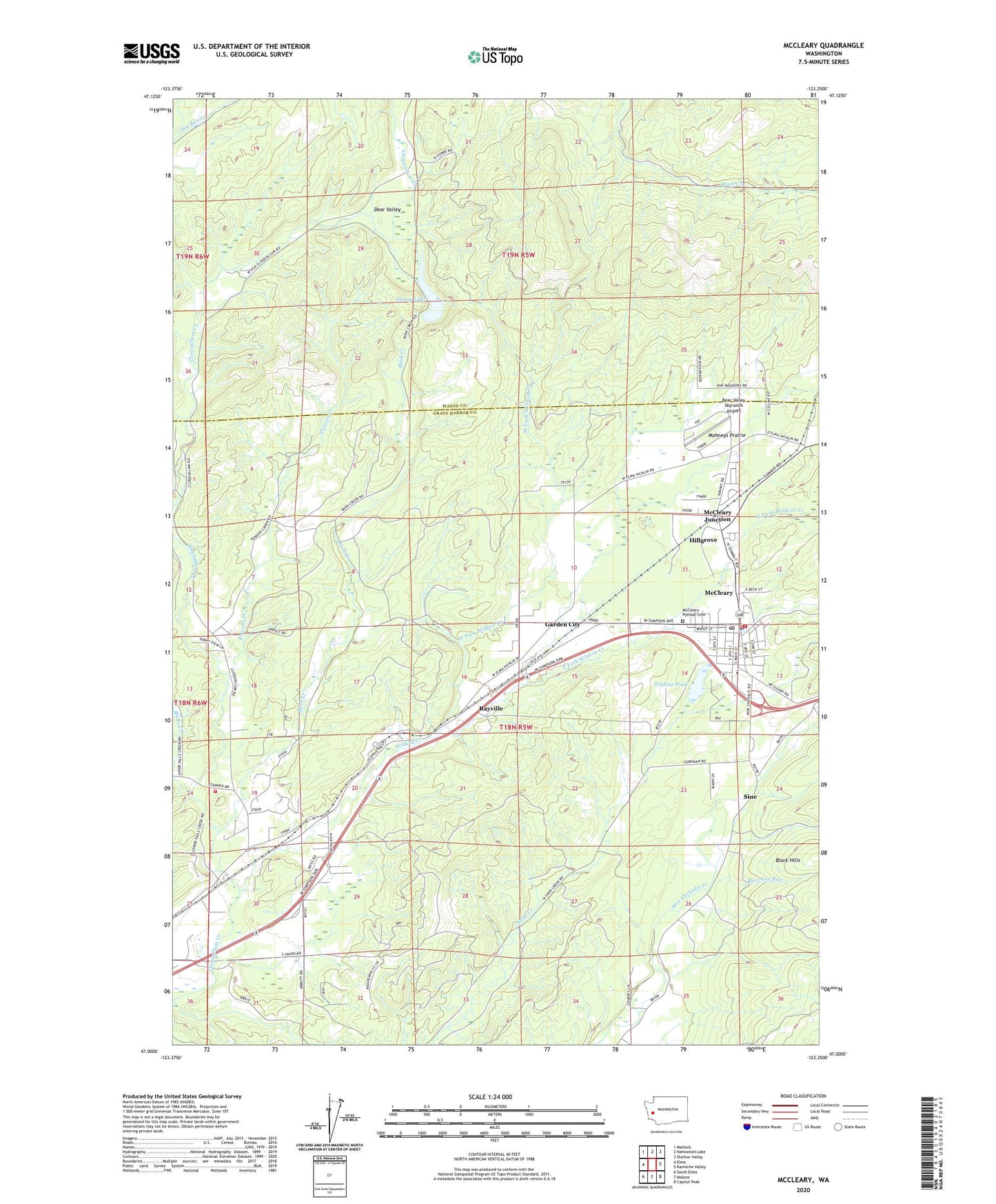
2023 topographic map quadrangle McCleary in the state of Washington. Scale: 1:24000. Based on the newly updated USGS 7.5' US Topo map series, this map is in the following counties: Grays Harbor, Mason. The map contains contour data, water features, and other items you are used to seeing on USGS maps, but also has updated roads and other features. This is the next generation of topographic maps. Printed on high-quality waterproof paper with UV fade-resistant inks.
Quads adjacent to this one:
West: Elma
Northwest: Matlock
North: Nahwatzel Lake
Northeast: Shelton Valley
East: Kamilche Valley
Southeast: Capitol Peak
South: Malone
Southwest: South Elma
This map covers the same area as the classic USGS quad with code o47123a3.
Contains the following named places: Bear Valley Skyranch Airport, Beehive Retirement Community, Bush Creek, City of McCleary, Cloquallum Truck Trail, East Fork Wildcat Creek, Falls Creek, Garden City, Garden City Pit, Grays Harbor Fire District 5 Station 51 Bush Creek, Hillgrove, Mark Reed Hospital Heliport, Mc Cleary Pythian Cemetery, McCleary, McCleary Assembly of God Church, McCleary City Hall, McCleary Community Center, McCleary Community Church, McCleary Division, McCleary Elementary School, McCleary Fire Department Grays Harbor Fire District 12, McCleary Junction, McCleary Police Department, McCleary Post Office, McCleary School District 065 Office, McCleary Sewage Treatment Plant, McCleary Timberland Library, McCleary Transit Station, McCleary United Methodist Church, Mohneys Prairie, Olympic Christian Center, Powers Creek, Raccoon Run, Rayville, Sine, Stump Lake, Viking West Mobile Home Park, West Fork Wildcat Creek, Whites, Wildcat Creek, Wildcat Pond, ZIP Code: 98557