MyTopo
Medicine Valley Washington US Topo Map
Couldn't load pickup availability
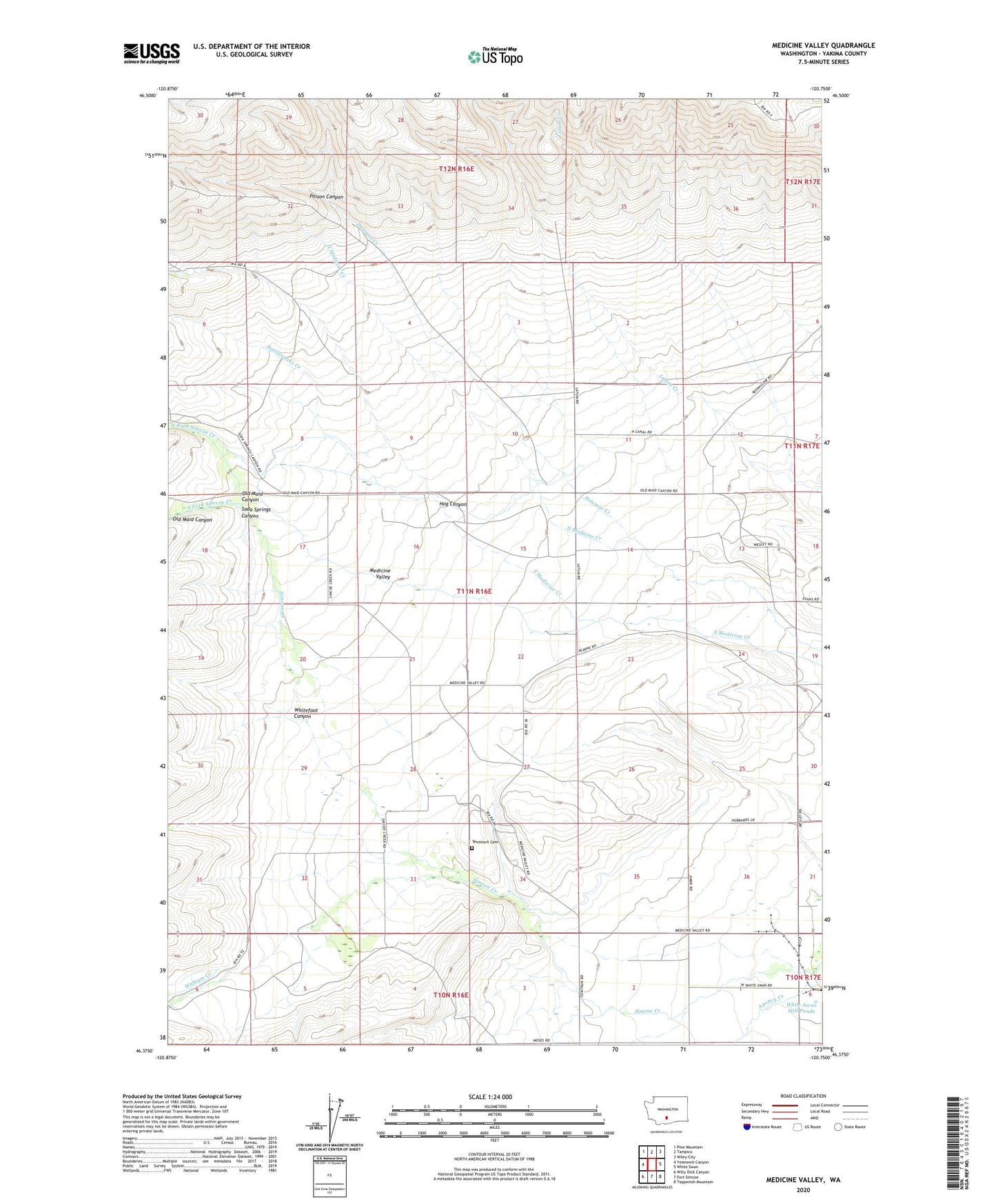
2023 topographic map quadrangle Medicine Valley in the state of Washington. Scale: 1:24000. Based on the newly updated USGS 7.5' US Topo map series, this map is in the following counties: Yakima. The map contains contour data, water features, and other items you are used to seeing on USGS maps, but also has updated roads and other features. This is the next generation of topographic maps. Printed on high-quality waterproof paper with UV fade-resistant inks.
Quads adjacent to this one:
West: Yesmowit Canyon
Northwest: Pine Mountain
North: Tampico
Northeast: Wiley City
East: White Swan
Southeast: Toppenish Mountain
South: Fort Simcoe
Southwest: Willy Dick Canyon
This map covers the same area as the classic USGS quad with code o46120d7.
Contains the following named places: Hog Canyon, North Fork Simcoe Creek, Old Maid Canyon, Patemas Creek, Poison Canyon, Rattlesnake Creek, Soda Springs Canyon, South Fork Simcoe Creek, Wahtum Creek, White Swan Mill Ponds, White Swan Substation, Whitefoot Canyon, Yesmowit Cemetery