MyTopo
Mesa West Washington US Topo Map
Couldn't load pickup availability
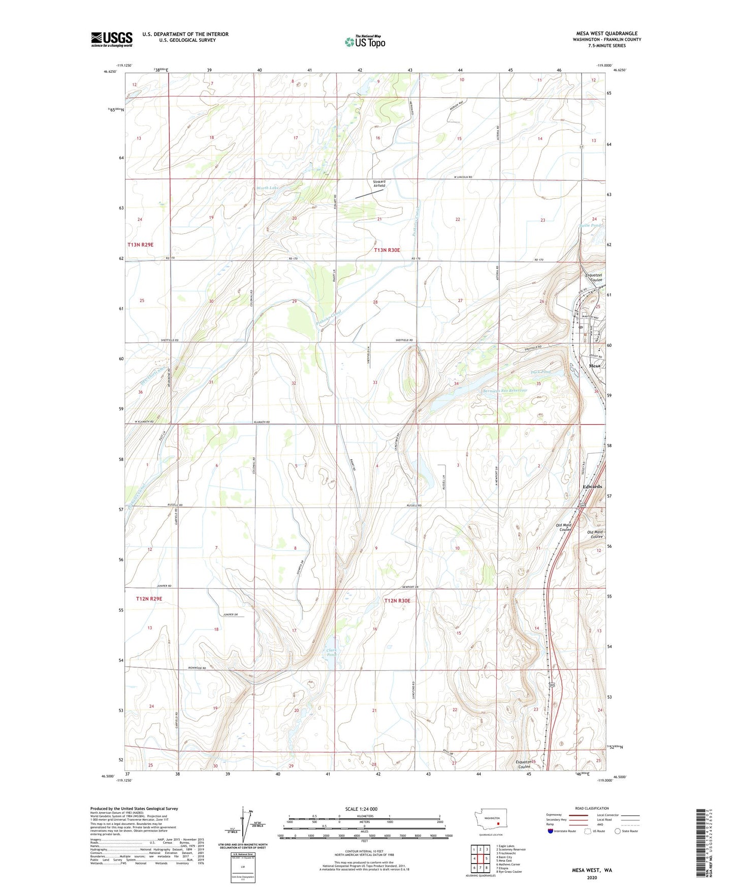
2020 topographic map quadrangle Mesa West in the state of Washington. Scale: 1:24000. Based on the newly updated USGS 7.5' US Topo map series, this map is in the following counties: Franklin. The map contains contour data, water features, and other items you are used to seeing on USGS maps, but also has updated roads and other features. This is the next generation of topographic maps. Printed on high-quality waterproof paper with UV fade-resistant inks.
Quads adjacent to this one:
West: Basin City
Northwest: Eagle Lakes
North: Scooteney Reservoir
Northeast: Frischknecht
East: Mesa East
Southeast: Rye Grass Coulee
South: Eltopia
Southwest: Mathews Corner
Contains the following named places: Bailie Pond, Bernsens 810 Reservoir, Bernsens 810 Reservoir Dam Number One, Bernsens 810 Reservoir Dam Number Three, Bernsens 810 Reservoir Dam Number Two, Bernsens Duck Pond Dam, City of Mesa, Clark Pond, DPE Thirtynine, Duck Pond, Edwards, Franklin County Public Hospital District 1 Ambulance Service, Hathaway Ranch Airport, Mesa, Mesa Elementary School, Mesa Lake, Mesa Post Office, Old Maid Coulee, Poe Park, Slinkard Airfield, Worth Lake