MyTopo
Eagle Lakes Washington US Topo Map
Couldn't load pickup availability
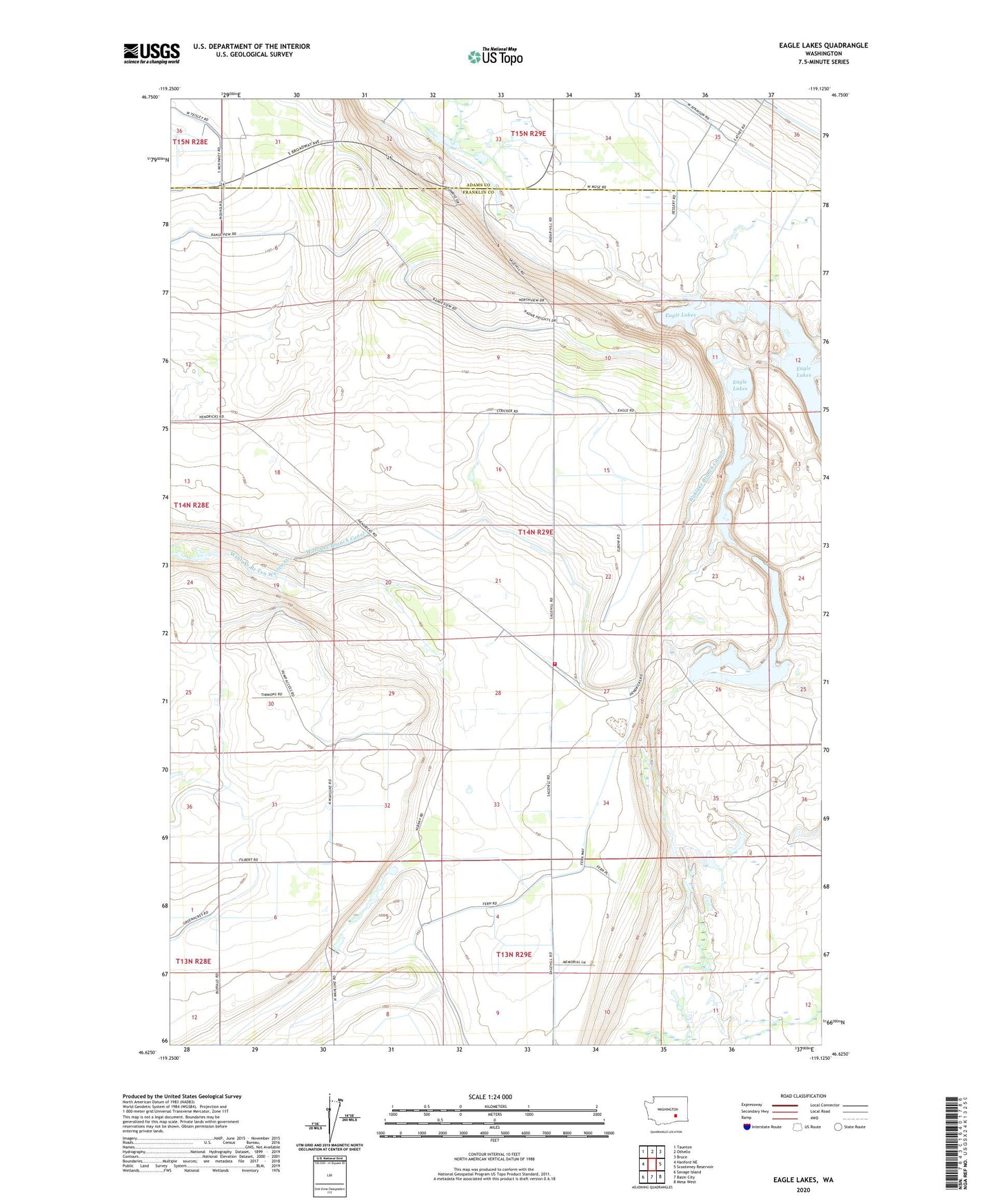
2023 topographic map quadrangle Eagle Lakes in the state of Washington. Scale: 1:24000. Based on the newly updated USGS 7.5' US Topo map series, this map is in the following counties: Franklin, Adams. The map contains contour data, water features, and other items you are used to seeing on USGS maps, but also has updated roads and other features. This is the next generation of topographic maps. Printed on high-quality waterproof paper with UV fade-resistant inks.
Quads adjacent to this one:
West: Hanford NE
Northwest: Taunton
North: Othello
Northeast: Bruce
East: Scooteney Reservoir
Southeast: Mesa West
South: Basin City
Southwest: Savage Island
This map covers the same area as the classic USGS quad with code o46119f2.
Contains the following named places: Bailie Memorial Boys Ranch, Eagle Lake Substation, Eagle Lakes, Franklin County Fire District 4 Station 3, Othello Air Force Station, Sagehill, Wahluke Branch Canal, Wahluke Siphon