
MyTopo
Mount Angeles Washington US Topo Map
Couldn't load pickup availability
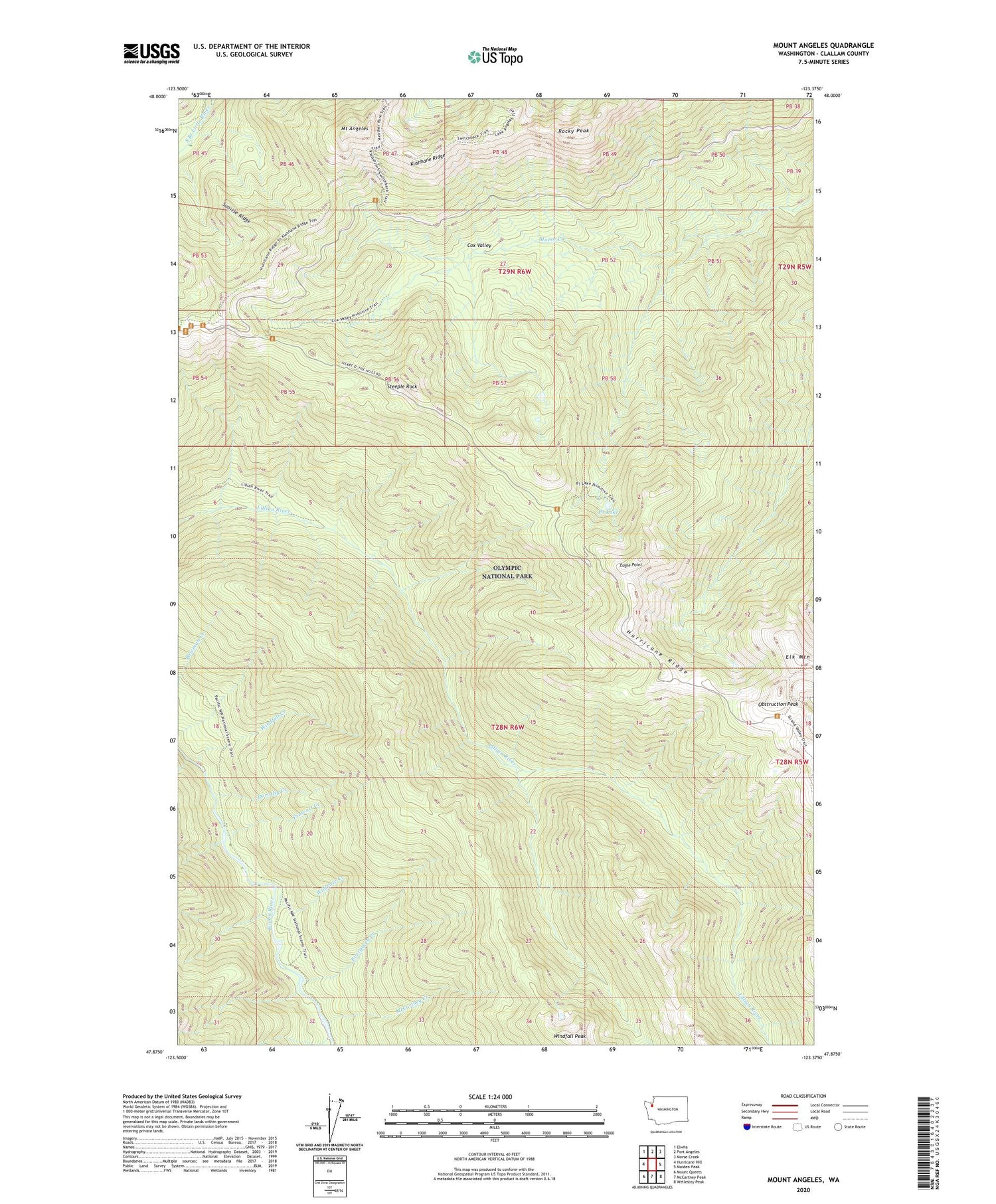
2020 topographic map quadrangle Mount Angeles in the state of Washington. Scale: 1:24000. Based on the newly updated USGS 7.5' US Topo map series, this map is in the following counties: Clallam. The map contains contour data, water features, and other items you are used to seeing on USGS maps, but also has updated roads and other features. This is the next generation of topographic maps. Printed on high-quality waterproof paper with UV fade-resistant inks.
Quads adjacent to this one:
West: Hurricane Hill
Northwest: Elwha
North: Port Angeles
Northeast: Morse Creek
East: Maiden Peak
Southeast: Wellesley Peak
South: McCartney Peak
Southwest: Mount Queets
Contains the following named places: Canyon Camp, Cox Valley, Dorothy Creek, Eagle Point, Evergreen Creek, Hurricane Ridge Picnic Area, Hurricane Ridge Visitors Center, Klahhane Ridge, Marys Falls Camp, McCartney Creek, Mount Angeles, Obstruction Peak, PJ Lake, Prescott Creek, Rocky Peak, Steeple Rock, Sunrise Ridge, Wildrose Creek, Windfall Creek, Windfall Peak


