MyTopo
Hurricane Hill Washington US Topo Map
Couldn't load pickup availability
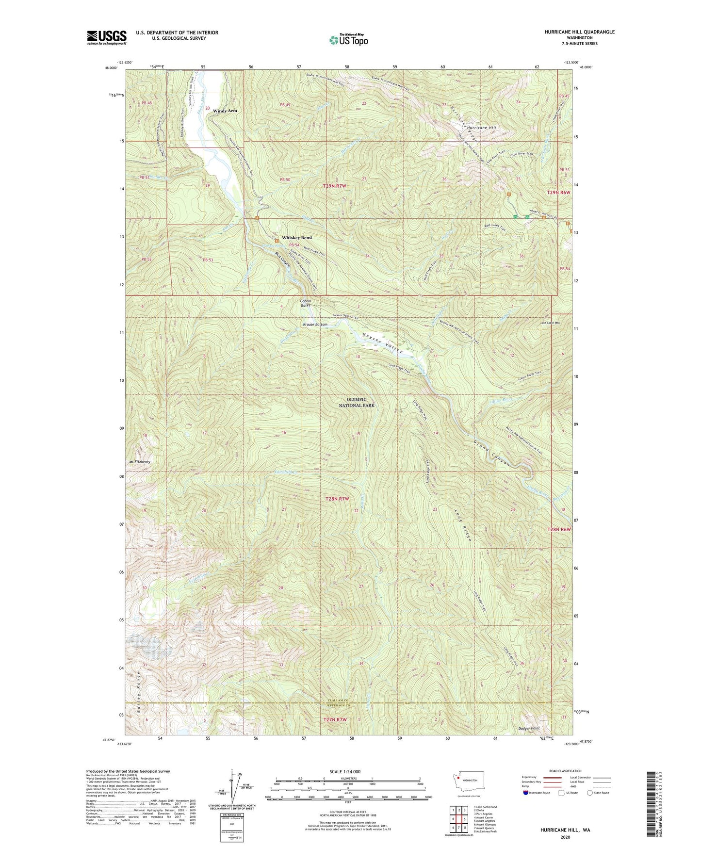
2023 topographic map quadrangle Hurricane Hill in the state of Washington. Scale: 1:24000. Based on the newly updated USGS 7.5' US Topo map series, this map is in the following counties: Clallam, Jefferson. The map contains contour data, water features, and other items you are used to seeing on USGS maps, but also has updated roads and other features. This is the next generation of topographic maps. Printed on high-quality waterproof paper with UV fade-resistant inks.
Quads adjacent to this one:
West: Mount Carrie
Northwest: Lake Sutherland
North: Elwha
Northeast: Port Angeles
East: Mount Angeles
Southeast: McCartney Peak
South: Mount Queets
Southwest: Mount Olympus
This map covers the same area as the classic USGS quad with code o47123h5.
Contains the following named places: Antelope Creek, Boulder Creek, Bowman Creek, Cat Creek, Fairchild Creek, Fitzhenry Creek, Geyser Valley, Goblin Gates, Grand Canyon, Haggerty Creek, Hurricane Creek, Hurricane Hill, Hurricane Hill Trail, Hurricane Ridge Ski Lodge, Idaho Creek, Krause Bottom, Lake Mills, Lillian River, Lillian River Trail, Lillian Shelter, Little River Trail, Long Creek, Long Ridge, Long Ridge Trail, Lost Cabin Mountain, Michaels Ranch, Rica Canyon, Sege Creek, Stukey Creek, Whiskey Bend, Windy Arm, Winslow Spring, Wolf Creek