MyTopo
Maiden Peak Washington US Topo Map
Couldn't load pickup availability
Also explore the Maiden Peak Forest Service Topo of this same quad for updated USFS data
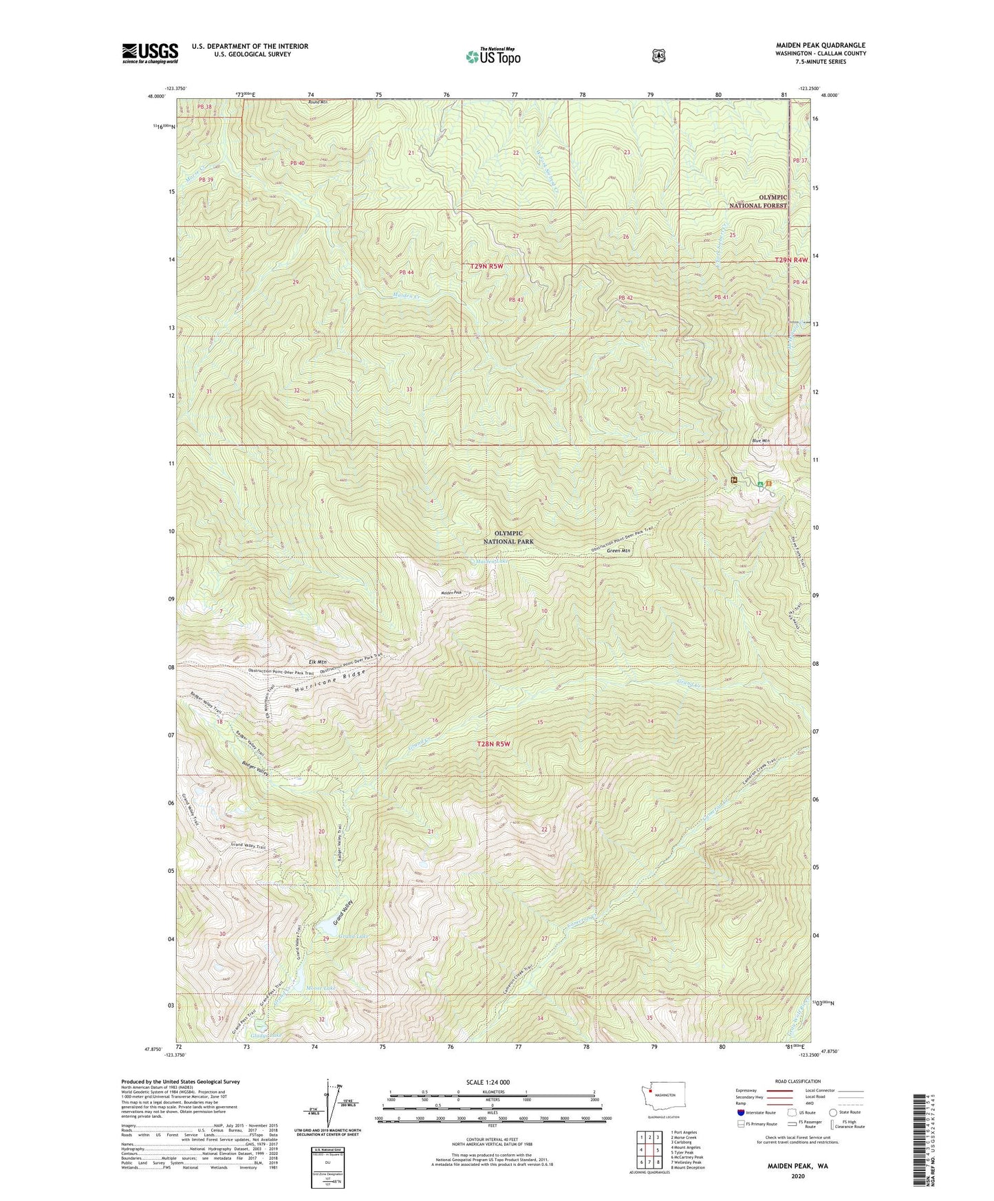
2023 topographic map quadrangle Maiden Peak in the state of Washington. Scale: 1:24000. Based on the newly updated USGS 7.5' US Topo map series, this map is in the following counties: Clallam. The map contains contour data, water features, and other items you are used to seeing on USGS maps, but also has updated roads and other features. This is the next generation of topographic maps. Printed on high-quality waterproof paper with UV fade-resistant inks.
Quads adjacent to this one:
West: Mount Angeles
Northwest: Port Angeles
North: Morse Creek
Northeast: Carlsborg
East: Tyler Peak
Southeast: Mount Deception
South: Wellesley Peak
Southwest: McCartney Peak
This map covers the same area as the classic USGS quad with code o47123h3.
Contains the following named places: Badger Valley, Blue Mountain, Deer Park, Deer Park Campground, Deer Park Ranger Station, Elk Mountain, Gladys Lake, Grand Lake, Grand Valley, Green Mountain, Hurricane Ridge, Maiden Creek, Maiden Lake, Maiden Peak, Moose Lake, Roaring Winds Camp, ZIP Code: 98362