MyTopo
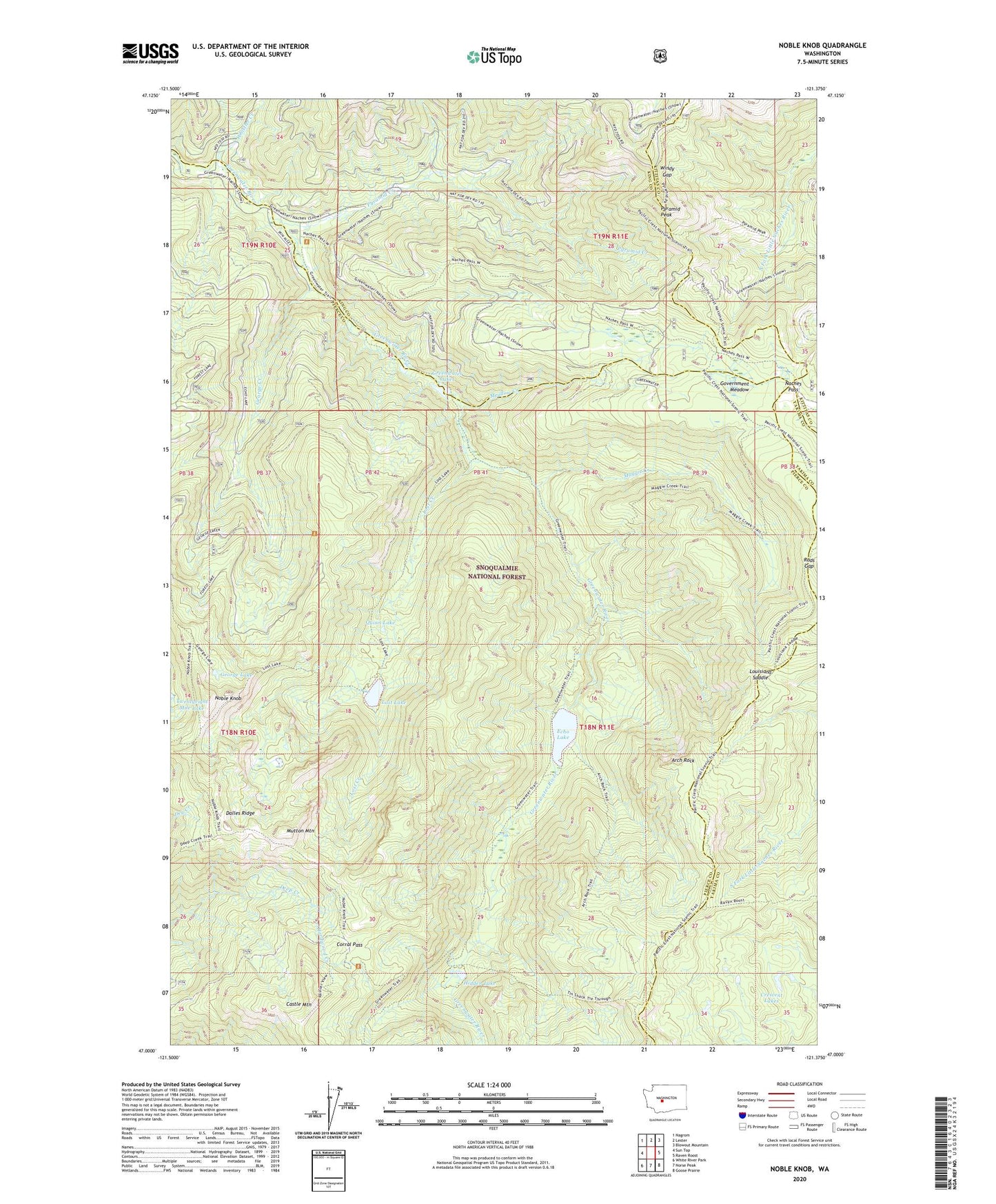
Noble Knob Washington US Topo Map
Couldn't load pickup availability
Also explore the Noble Knob Forest Service Topo of this same quad for updated USFS data
2023 topographic map quadrangle Noble Knob in the state of Washington. Scale: 1:24000. Based on the newly updated USGS 7.5' US Topo map series, this map is in the following counties: Pierce, King, Yakima, Kittitas. The map contains contour data, water features, and other items you are used to seeing on USGS maps, but also has updated roads and other features. This is the next generation of topographic maps. Printed on high-quality waterproof paper with UV fade-resistant inks.
Quads adjacent to this one:
West: Sun Top
Northwest: Nagrom
North: Lester
Northeast: Blowout Mountain
East: Raven Roost
Southeast: Goose Prairie
South: Norse Peak
Southwest: White River Park
This map covers the same area as the classic USGS quad with code o47121a4.
Contains the following named places: Arch Rock, Arch Rock Shelter, Camp Urich, Corral Pass, Cougar Valley Trail, Crescent Lakes, Dalles Ridge Trail, Echo Lake, George Creek, George Lake, Government Meadow, Government Meadow Camp, Greenwater Lakes, Greenwater Trail, Hardwood Creek, Hidden Lake, Last Crossing, Lost Creek, Lost Lake, Lost Lake Trail, Louisiana Saddle, Maggie Creek, Maggie Creek Trail, Meadow Creek, Mutton Mountain, Naches Pass, Naches Pass-Greenwater Trail, Noble Knob, Norse Peak Wilderness, Pyramid Creek, Pyramid Peak, Pyramid Peak Lookout, Quinn Lake, Rods Gap, Whistler Creek, Windy Gap