MyTopo
Palouse Washington US Topo Map
Couldn't load pickup availability
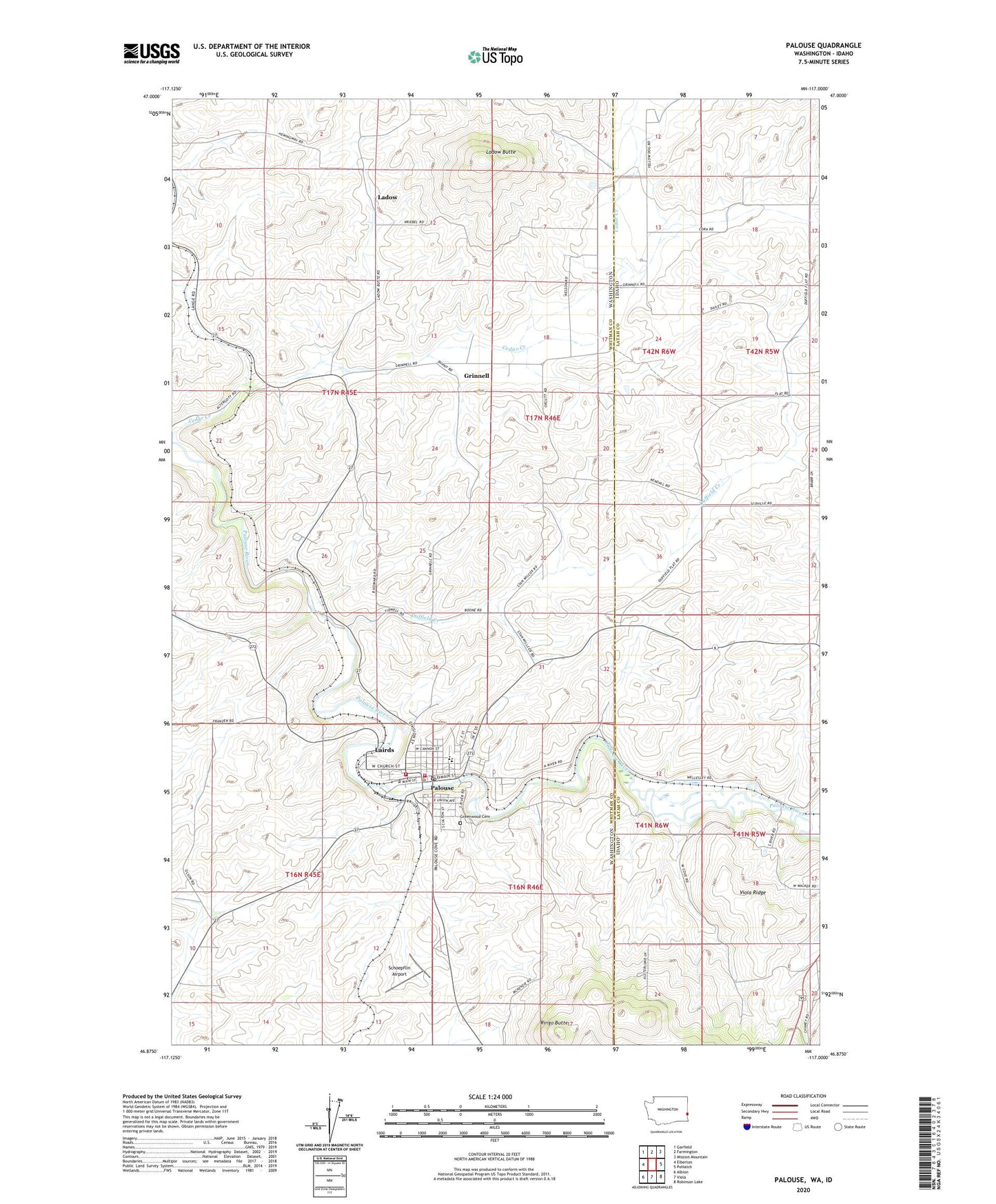
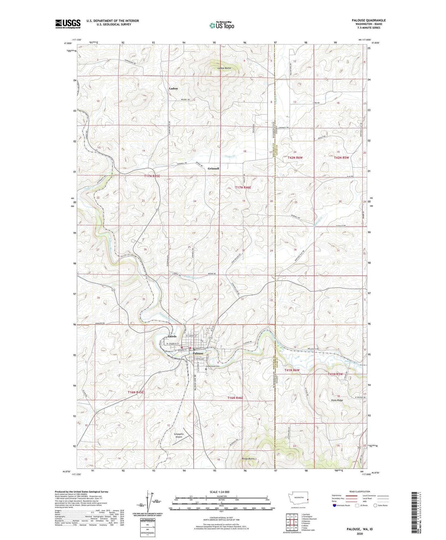
2020 topographic map quadrangle Palouse in the states of Washington, Idaho. Scale: 1:24000. Based on the newly updated USGS 7.5' US Topo map series, this map is in the following counties: Whitman, Latah. The map contains contour data, water features, and other items you are used to seeing on USGS maps, but also has updated roads and other features. This is the next generation of topographic maps. Printed on high-quality waterproof paper with UV fade-resistant inks.
Quads adjacent to this one:
West: Elberton
Northwest: Garfield
North: Farmington
Northeast: Mission Mountain
East: Potlatch
Southeast: Robinson Lake
South: Viola
Southwest: Albion
Contains the following named places: Cedar, Cedar Creek, City of Palouse, Duffield Creek, Garfield - Palouse High School, Greenwood Cemetery, Grinnell, Horn, Jamestown, Ladow, Ladow Butte, Lairds, Palouse, Palouse Elementary School, Palouse Fire Department, Palouse Police Department, Palouse Post Office, Ringo Butte, Schoepflin Airport, Viola Ridge, Wellesley, Whitman County Fire District 4 Palouse Fire Department and Emergency Medical Services Station 1, Yellow Dog