MyTopo
Robinson Lake Idaho US Topo Map
Couldn't load pickup availability
Also explore the Robinson Lake Forest Service Topo of this same quad for updated USFS data
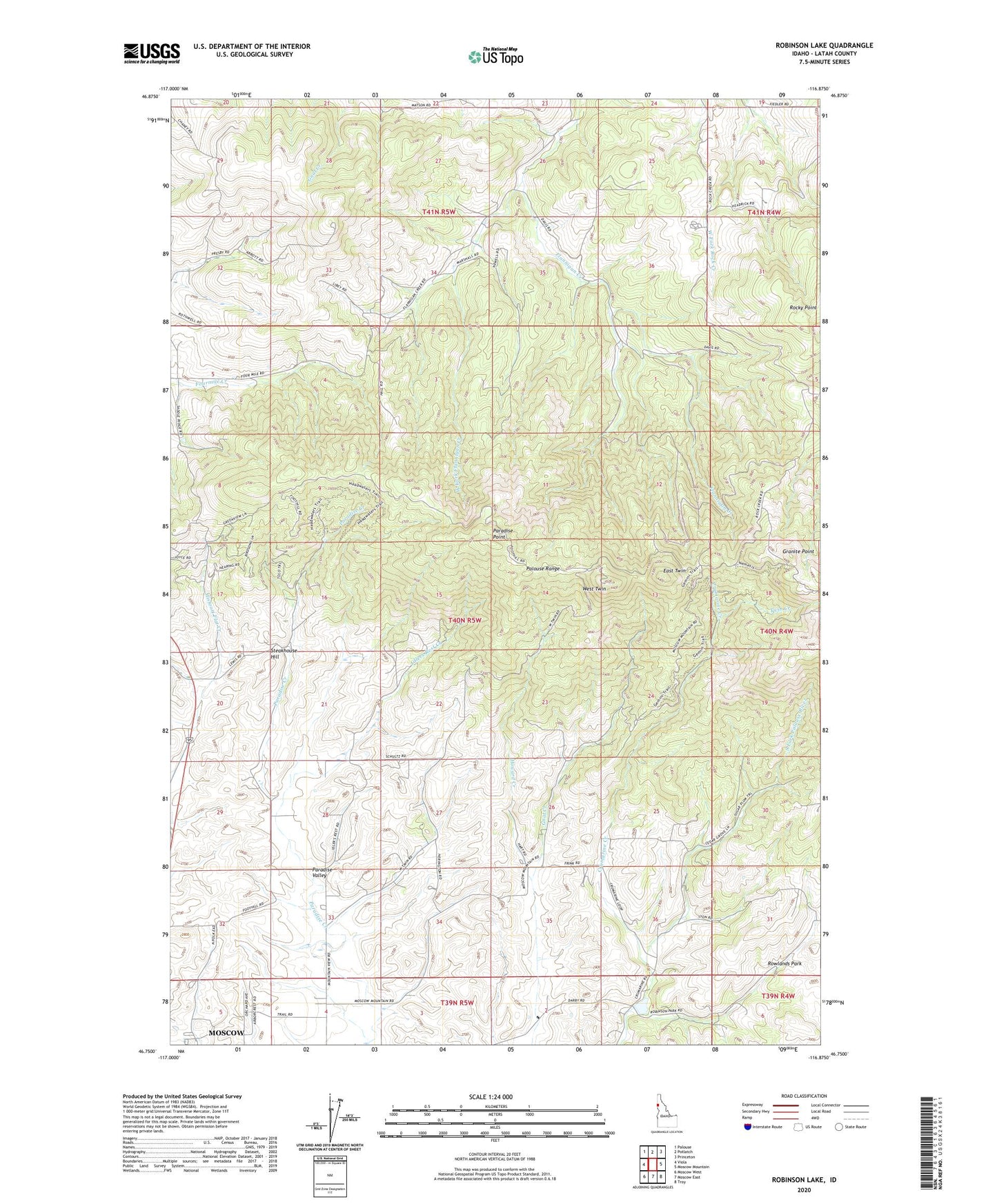
2024 topographic map quadrangle Robinson Lake in the state of Idaho. Scale: 1:24000. Based on the newly updated USGS 7.5' US Topo map series, this map is in the following counties: Latah. The map contains contour data, water features, and other items you are used to seeing on USGS maps, but also has updated roads and other features. This is the next generation of topographic maps. Printed on high-quality waterproof paper with UV fade-resistant inks.
Quads adjacent to this one:
West: Viola
Northwest: Palouse
North: Potlatch
Northeast: Princeton
East: Moscow Mountain
Southeast: Troy
South: Moscow East
Southwest: Moscow West
This map covers the same area as the classic USGS quad with code o46116g8.
Contains the following named places: Advent Hollow, Crumarine Creek, East Twin, Granite Point, Howard Creek, Idlers Rest Creek, Mission Spring, Paradise Point, Robinson Lake, Rocky Point, Rowlands Park, Steakhouse Hill, Twin Creek, West Fork Flannigan Creek, West Twin, White Cross Mine, ZIP Code: 83872