MyTopo
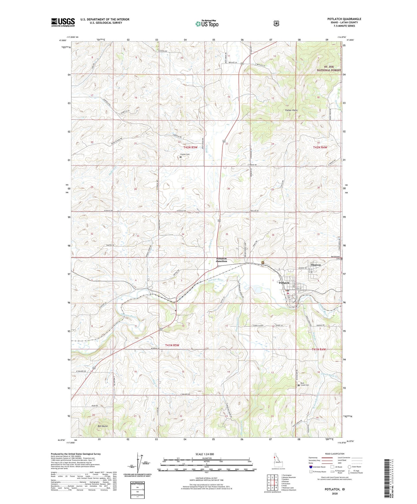
Potlatch Idaho US Topo Map
Couldn't load pickup availability
Also explore the Potlatch Forest Service Topo of this same quad for updated USFS data
2024 topographic map quadrangle Potlatch in the state of Idaho. Scale: 1:24000. Based on the newly updated USGS 7.5' US Topo map series, this map is in the following counties: Latah. The map contains contour data, water features, and other items you are used to seeing on USGS maps, but also has updated roads and other features. This is the next generation of topographic maps. Printed on high-quality waterproof paper with UV fade-resistant inks.
Quads adjacent to this one:
West: Palouse
Northwest: Farmington
North: Mission Mountain
Northeast: Sanders
East: Princeton
Southeast: Moscow Mountain
South: Robinson Lake
Southwest: Viola
This map covers the same area as the classic USGS quad with code o46116h8.
Contains the following named places: Anderson-Plummer Airport, Ball Butte, City of Onaway, City of Potlatch, Deep Creek, East Fork Rock Creek, Farber Point, Flannigan Creek, Freeze, Freeze Cemetery, Gnat Creek, Kennedy Ford, Mendenhall Cemetery, Onaway, Palouse District Ranger Station, Potlatch, Potlatch Elementary School, Potlatch Junction, Potlatch Junior - Senior High School, Potlatch Post Office, Potlatch Rural Fire District, Rock Creek, Rock Creek Cemetery, West Fork Rock Creek, ZIP Code: 83855