MyTopo
Park Lake Washington US Topo Map
Couldn't load pickup availability
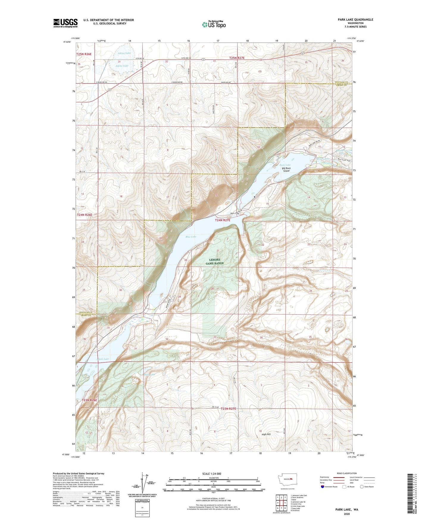
2020 topographic map quadrangle Park Lake in the state of Washington. Scale: 1:24000. Based on the newly updated USGS 7.5' US Topo map series, this map is in the following counties: Grant, Douglas. The map contains contour data, water features, and other items you are used to seeing on USGS maps, but also has updated roads and other features. This is the next generation of topographic maps. Printed on high-quality waterproof paper with UV fade-resistant inks.
Quads adjacent to this one:
West: Jameson Lake SE
Northwest: Jameson Lake East
North: Saint Andrews
Northeast: Mold
East: Coulee City
Southeast: Stratford
South: Soap Lake
Southwest: Little Soap Lake
Contains the following named places: Alkali Lake, Atkins Lake, Baird, Big Rock Island, Blue Lake, Bluff Lake, Churchill Draw, Cook Draw, Deer Canyon, Dry Coulee, Granny Draw, Hybel Canyon, Jasper Canyon, Lenore Game Range, Meadow Creek, Mirror Lake, Park Lake