MyTopo
Mold Washington US Topo Map
Couldn't load pickup availability
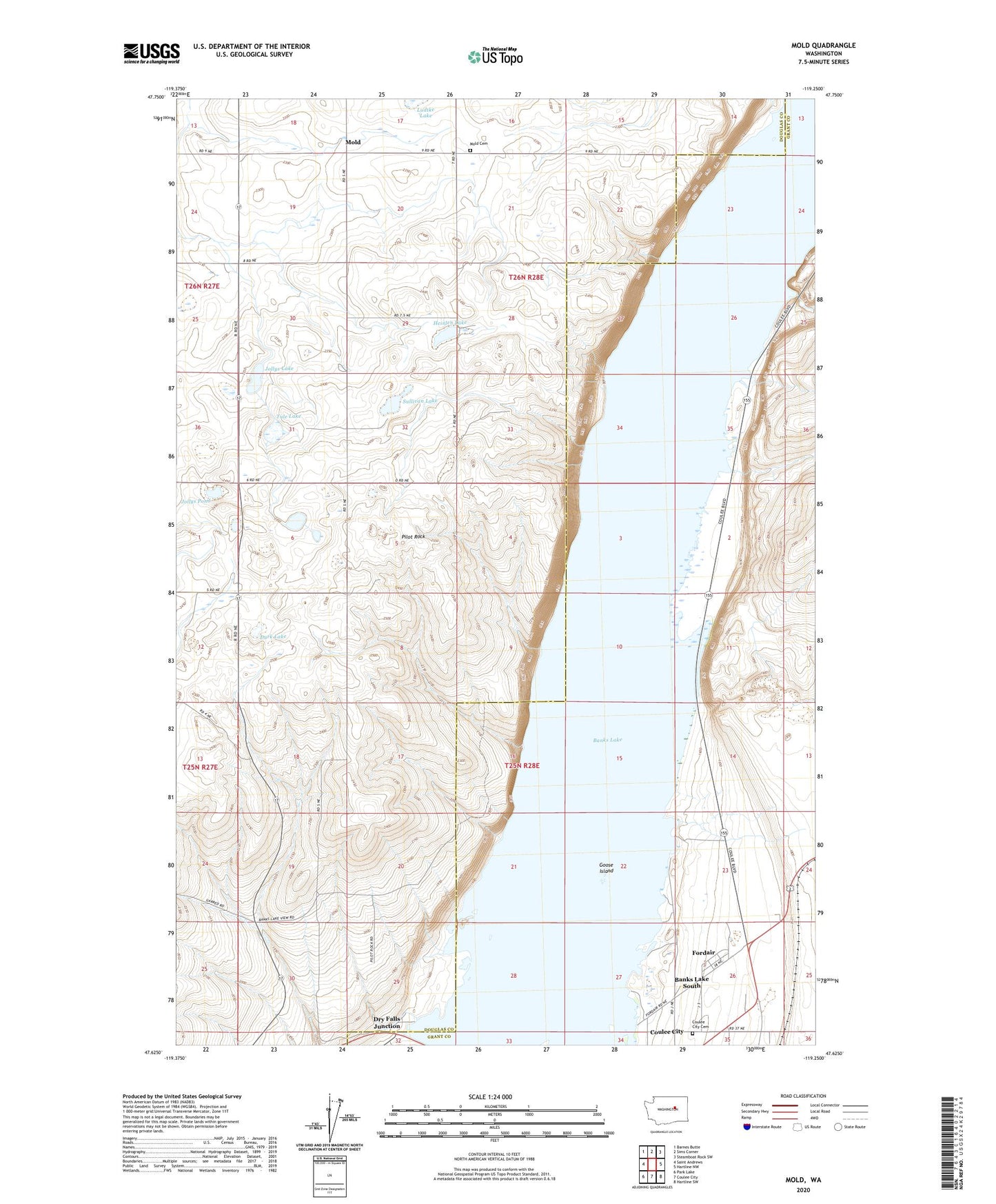
2023 topographic map quadrangle Mold in the state of Washington. Scale: 1:24000. Based on the newly updated USGS 7.5' US Topo map series, this map is in the following counties: Douglas, Grant. The map contains contour data, water features, and other items you are used to seeing on USGS maps, but also has updated roads and other features. This is the next generation of topographic maps. Printed on high-quality waterproof paper with UV fade-resistant inks.
Quads adjacent to this one:
West: Saint Andrews
Northwest: Barnes Butte
North: Sims Corner
Northeast: Steamboat Rock SW
East: Hartline NW
Southeast: Hartline SW
South: Coulee City
Southwest: Park Lake
This map covers the same area as the classic USGS quad with code o47119f3.
Contains the following named places: Banks Lake South Census Designated Place, Chase Draw, Coulee City Cemetery, Dry Falls Junction, Durk Lake, Fordair, Goose Island, Heinlen Lake, Jollys Lake, Jollys Pond, Ludtke Lake, McDonald Draw, Mold, Mold Cemetery, Pilot Rock, Purdue Draw, Saint Andrews Substation, Shrock Draw, Sullivan Lake, Tule Lake