MyTopo
Coulee City Washington US Topo Map
Couldn't load pickup availability
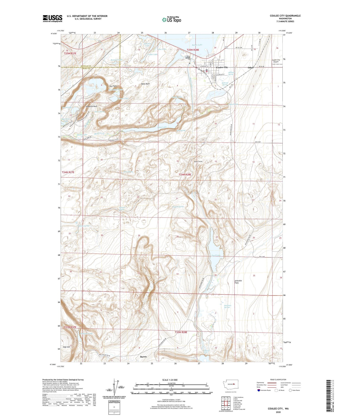
2023 topographic map quadrangle Coulee City in the state of Washington. Scale: 1:24000. Based on the newly updated USGS 7.5' US Topo map series, this map is in the following counties: Grant, Douglas. The map contains contour data, water features, and other items you are used to seeing on USGS maps, but also has updated roads and other features. This is the next generation of topographic maps. Printed on high-quality waterproof paper with UV fade-resistant inks.
Quads adjacent to this one:
West: Park Lake
Northwest: Saint Andrews
North: Mold
Northeast: Hartline NW
East: Hartline SW
Southeast: Wilson Creek NW
South: Stratford
Southwest: Soap Lake
This map covers the same area as the classic USGS quad with code o47119e3.
Contains the following named places: Almira Coulee Hartline High School, Arbuckle Draw, Arbuckle Flats, Bacon, Bacon Siphon, Bacon Tunnel, Castle Lake, Coulee City, Coulee City Airport, Coulee City Elementary School, Coulee City Fire Department, Coulee City Police Department, Coulee City Post Office, Coulee Lake, Coyote Spring, Deadman Springs, Deep Lake, Deep Lake Dam, Delany Spring, Don Paul Draw, Dry Falls, Dry Falls Dam, Dry Falls Heritage Area, Dry Falls Lake, Falls Lake Dam, Green Lake, Haynes Canyon, Hudson Coulee, Hudson Spring, Junction Lake, Lena Lake, McEntee Spring, Meadow Lake, Odair, Perch Lake, Perry Spring, Railroad Spring, Rainbow Lake, Red Alkali Lake, Rickard Lake, Seepage Spring, Spring Creek, Summer Falls, Summer Falls State Park, Sun Lakes State Park, Table Lake, Table Rock, Town of Coulee City, Trail Lake, Trail Lake Coulee, Umatilla Rock, Upper Grand Coulee, Wall Spring, Williams Lake, Willow Spring