MyTopo
Pe Ell Washington US Topo Map
Couldn't load pickup availability
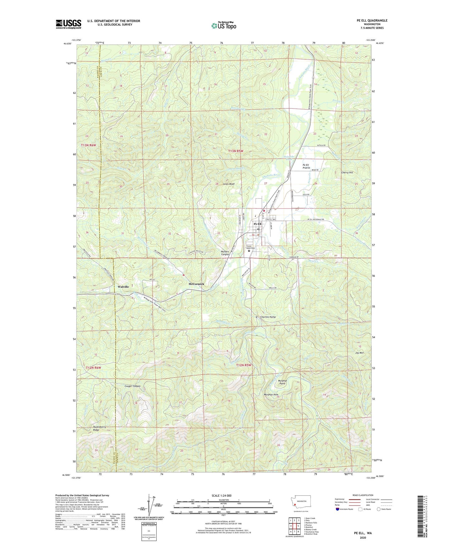
2020 topographic map quadrangle Pe Ell in the state of Washington. Scale: 1:24000. Based on the newly updated USGS 7.5' US Topo map series, this map is in the following counties: Lewis, Pacific. The map contains contour data, water features, and other items you are used to seeing on USGS maps, but also has updated roads and other features. This is the next generation of topographic maps. Printed on high-quality waterproof paper with UV fade-resistant inks.
Quads adjacent to this one:
West: Pluvius
Northwest: Dean Creek
North: Doty
Northeast: Rainbow Falls
East: Boistfort
Southeast: Boistfort Peak
South: Elochoman Pass
Southwest: Blaney Creek
Contains the following named places: Big Creek, Browns Creek, Cannonball Creek, Charlies Hump, Cherry Hill, Cougar Canyon, Crim Creek, Fisk Falls, Forest Lawn Cemetery, Fronia Creek, Helmicks Pond, Huckleberry Ridge, Hull Creek, Jones Bluff, Jones Creek, Joy Mountain, Katula Creek, Kowalski Creek, Lester Creek, Lester Creek Reservoir, Lester Creek Reservoir Dam, Lewis County Fire District 11 Station 1, Lewis County Fire District 11 Station 2, Mahaffey Creek, McCormick, McCormick Creek, Mullers Canyon, Murphys Hole, Murphys Point, Pe Ell, Pe Ell Ambulance, Pe Ell Post Office, Pe Ell Prairie, Pe Ell School, Reynolds, Robinson Creek, Rock Creek, Roger Creek, Sand Creek, Shields Creek, Stowe Creek, Town of Pe Ell, Walville, Water Mill Creek, ZIP Code: 98572