MyTopo
Elochoman Pass Washington US Topo Map
Couldn't load pickup availability
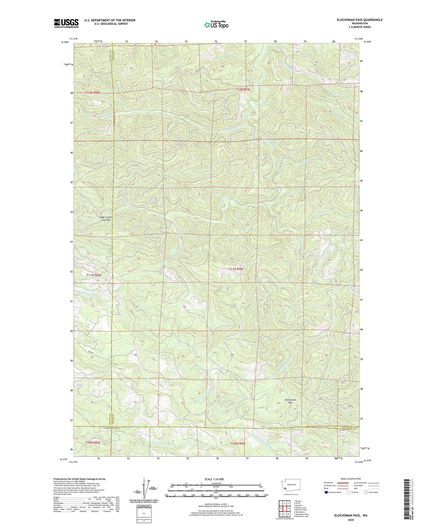
2023 topographic map quadrangle Elochoman Pass in the state of Washington. Scale: 1:24000. Based on the newly updated USGS 7.5' US Topo map series, this map is in the following counties: Lewis, Pacific, Wahkiakum. The map contains contour data, water features, and other items you are used to seeing on USGS maps, but also has updated roads and other features. This is the next generation of topographic maps. Printed on high-quality waterproof paper with UV fade-resistant inks.
Quads adjacent to this one:
West: Blaney Creek
Northwest: Pluvius
North: Pe Ell
Northeast: Boistfort
East: Boistfort Peak
Southeast: Elochoman Lake
South: Skamokawa Pass
Southwest: Skamokawa
This map covers the same area as the classic USGS quad with code o46123d3.
Contains the following named places: Alder Creek, Big Roger Creek, Cinnabar Creek, East Fork Chehalis River, Elochoman Pass, George Creek, Little Roger Creek, Mack Creek, Sage Creek, Sage Creek Low Gap, Smith Creek, Thrash Creek, West Fork Chehalis River