MyTopo
Boistfort Washington US Topo Map
Couldn't load pickup availability
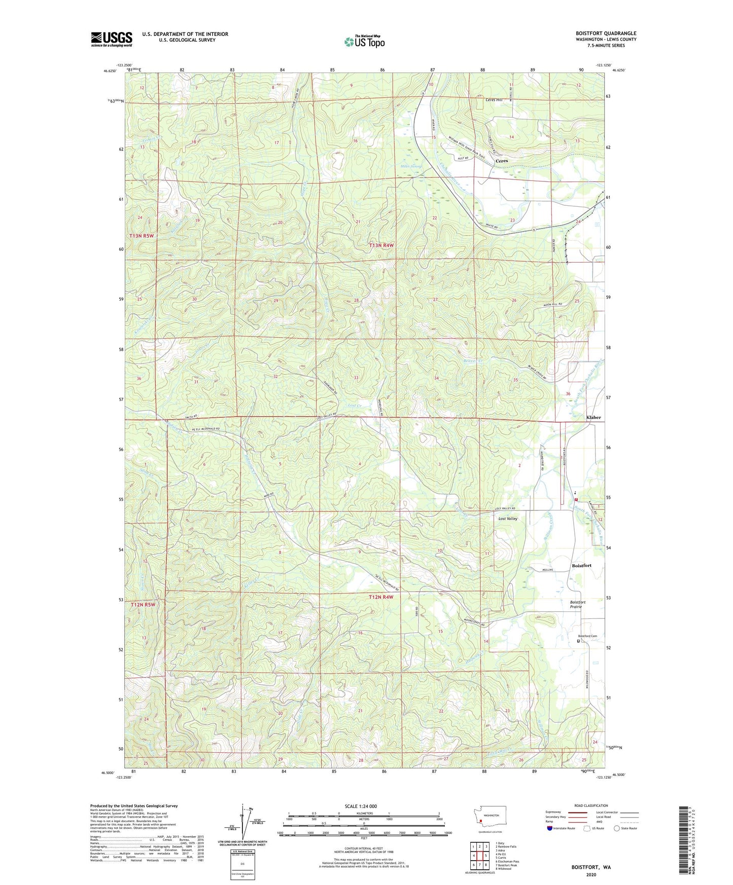
2023 topographic map quadrangle Boistfort in the state of Washington. Scale: 1:24000. Based on the newly updated USGS 7.5' US Topo map series, this map is in the following counties: Lewis. The map contains contour data, water features, and other items you are used to seeing on USGS maps, but also has updated roads and other features. This is the next generation of topographic maps. Printed on high-quality waterproof paper with UV fade-resistant inks.
Quads adjacent to this one:
West: Pe Ell
Northwest: Doty
North: Rainbow Falls
Northeast: Adna
East: Curtis
Southeast: Wildwood
South: Boistfort Peak
Southwest: Elochoman Pass
This map covers the same area as the classic USGS quad with code o46123e2.
Contains the following named places: Beaver Creek, Boistford Cemetery, Boistfort, Boistfort Elementary School, Boistfort Park, Boistfort Prairie, Camp McDonald, Ceres, Ceres Hill, Halfway Creek, Halsea Creek, Keller Creek, Kesting Dairy, Klaber, Lewis County Fire District 13 Station 1, Little Mill Creek, Lost Creek, Lost Valley, Miller Swamp, Slide Creek, Stillman Creek, Winlock-Pe Ell Division