MyTopo
Point Roberts Washington US Topo Map
Couldn't load pickup availability
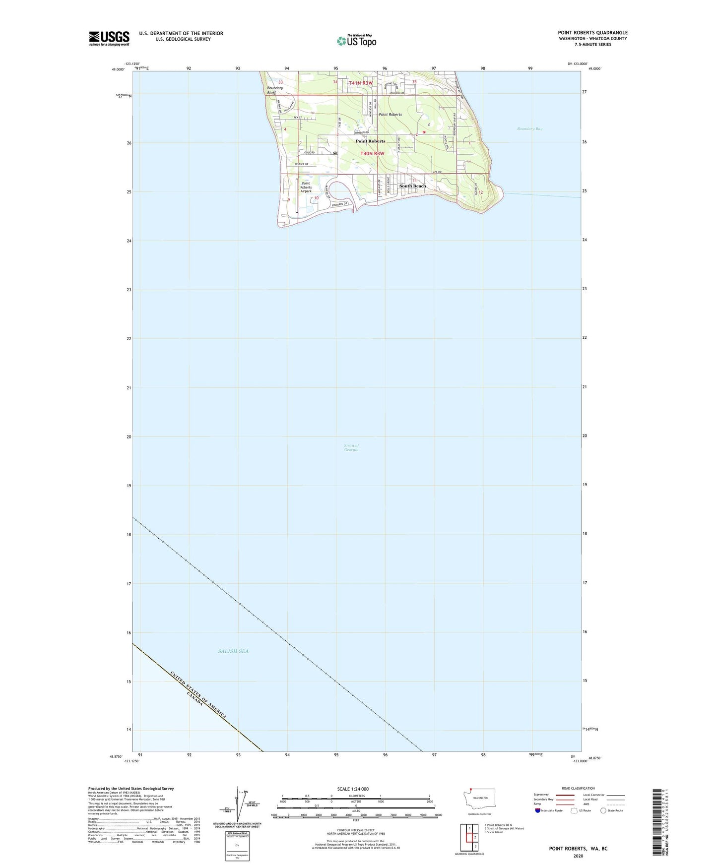
2023 topographic map quadrangle Point Roberts in the state of Washington. Scale: 1:24000. Based on the newly updated USGS 7.5' US Topo map series, this map is in the following counties: Whatcom. The map contains contour data, water features, and other items you are used to seeing on USGS maps, but also has updated roads and other features. This is the next generation of topographic maps. Printed on high-quality waterproof paper with UV fade-resistant inks.
Quads adjacent to this one:
North: Point Roberts OE N
Southeast: Sucia Island
This map covers the same area as the classic USGS quad with code o48123h1.
Contains the following named places: Boundary Bluff, Gulfaire Mobile Villa, Lighthouse Marine Park Boat Launch, Lighthouse Marine Park Campground, Northwest Grange, Point Roberts, Point Roberts Airpark, Point Roberts Census Designated Place, Point Roberts Division, Point Roberts Golf and Country Club, Point Roberts Library, Point Roberts Lighthouse, Point Roberts Military Reservation, Point Roberts Post Office, Point Roberts Primary School, Point Roberts Resort Marina, Salish Sea, South Beach, Trinity Community Lutheran Church, Whatcom County Fire District 5, ZIP Code: 98281