MyTopo
Pullman Washington US Topo Map
Couldn't load pickup availability
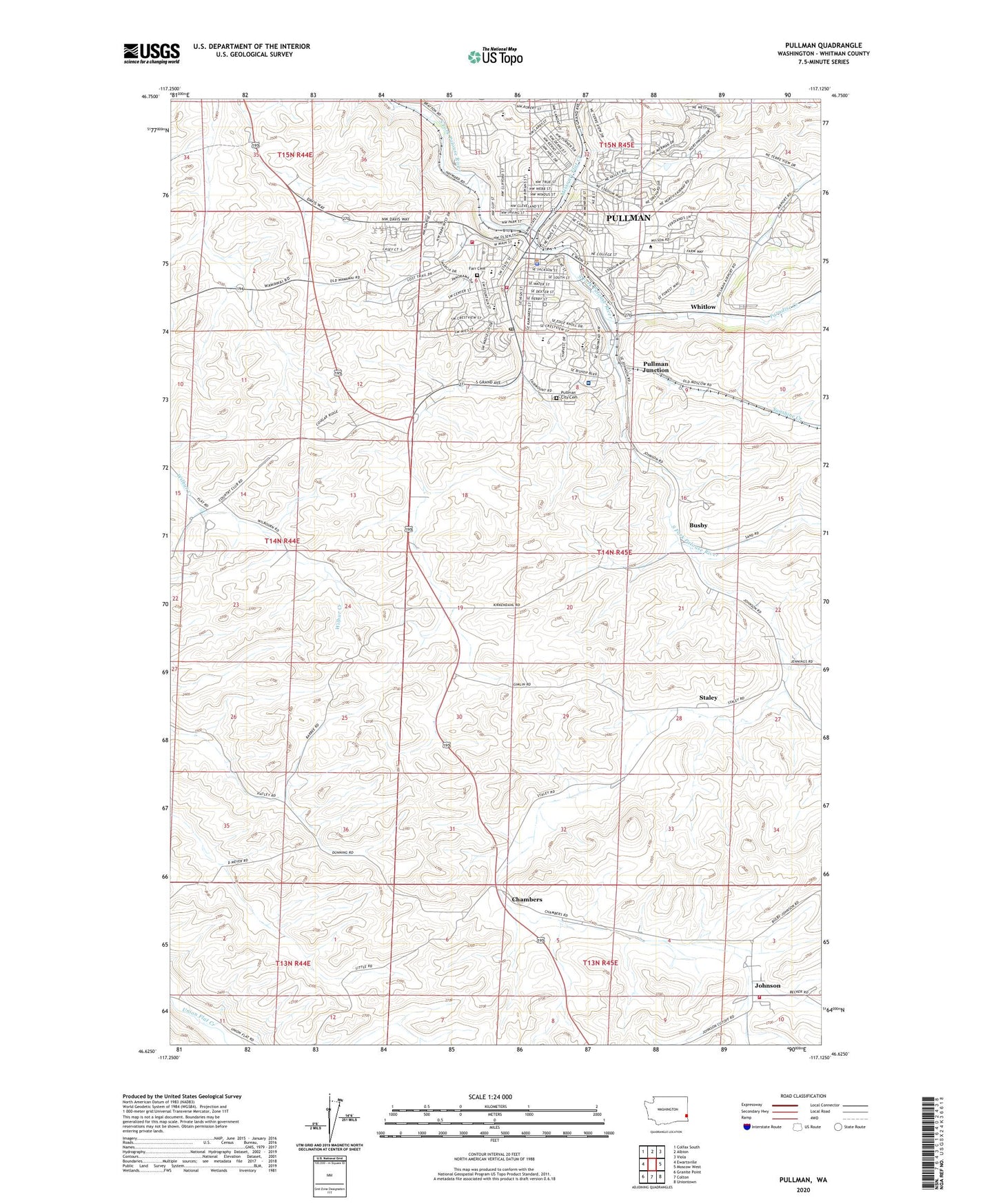
2020 topographic map quadrangle Pullman in the state of Washington. Scale: 1:24000. Based on the newly updated USGS 7.5' US Topo map series, this map is in the following counties: Whitman. The map contains contour data, water features, and other items you are used to seeing on USGS maps, but also has updated roads and other features. This is the next generation of topographic maps. Printed on high-quality waterproof paper with UV fade-resistant inks.
Quads adjacent to this one:
West: Ewartsville
Northwest: Colfax South
North: Albion
Northeast: Viola
East: Moscow West
Southeast: Uniontown
South: Colton
Southwest: Granite Point
Contains the following named places: Busby, Chambers, City of Pullman, Edison School, Farr Cemetery, Franklin Elementary School, Jefferson Elementary School, Johnson, KQQQ-AM (Pullman), KWSU-AM (Pullman), KZUU-FM (Pullman), Lincoln Middle School, Missouri Flat Creek, Paradise Creek, Pullman, Pullman Christian School, Pullman City Cemetery, Pullman Division, Pullman Fire Department Station 31, Pullman High School, Pullman Junction, Pullman Police Department, Pullman Post Office, Pullman Regional Hospital, Rogers Field, Royal Garrison School, Staley, Staley Airport, Staley Siding, Sunnyside Elementary School, Sunshine Creek, Washington State University, Wheatland Shopping Center, Whitlow, Whitman County Fire District 12 Station 12 - 1, Whitman County Fire District 12 Station 12 - 2, Wilma, Woodcroft Park, ZIP Codes: 99163, 99164