MyTopo
Granite Point Washington US Topo Map
Couldn't load pickup availability
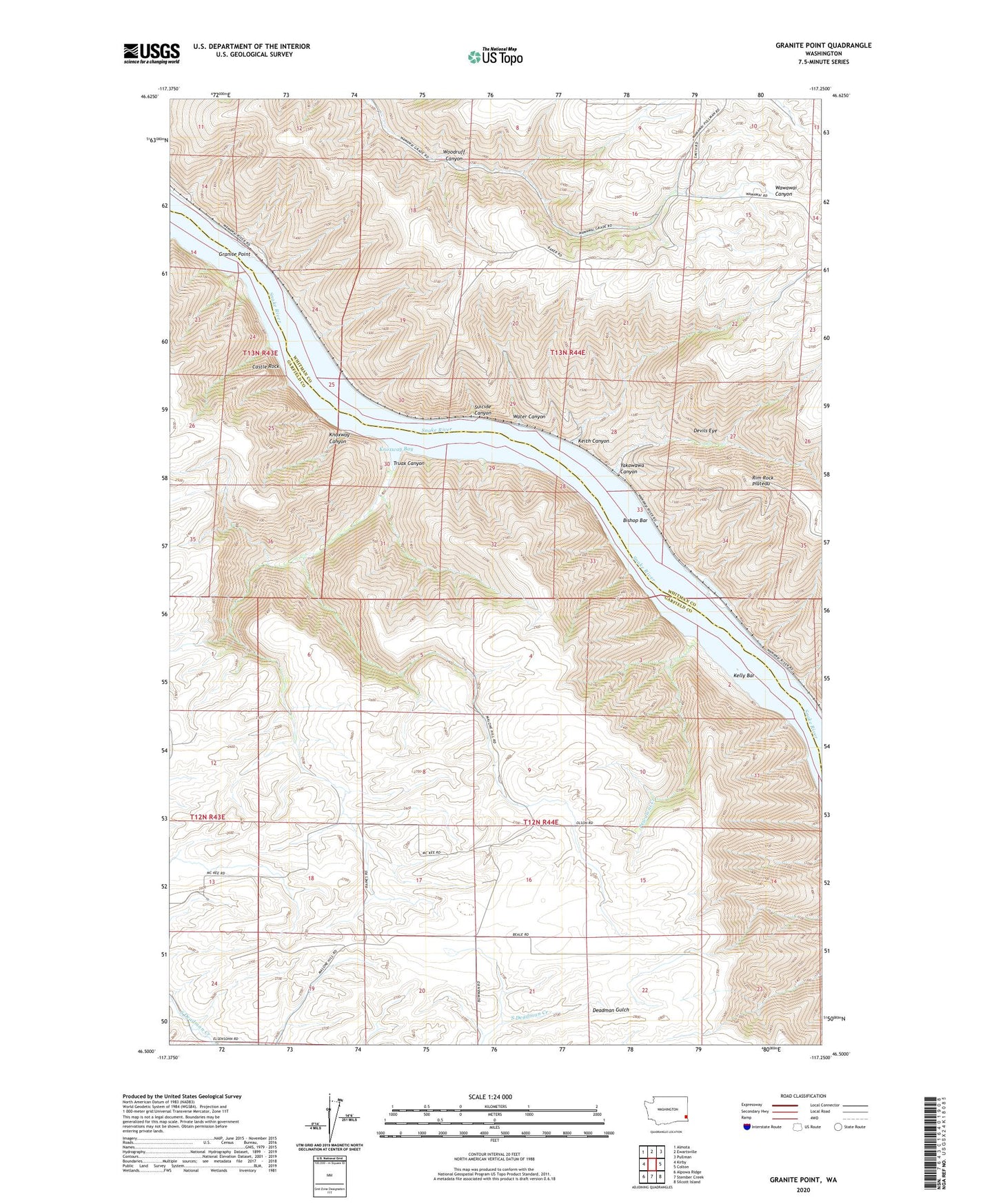
2023 topographic map quadrangle Granite Point in the state of Washington. Scale: 1:24000. Based on the newly updated USGS 7.5' US Topo map series, this map is in the following counties: Garfield, Whitman. The map contains contour data, water features, and other items you are used to seeing on USGS maps, but also has updated roads and other features. This is the next generation of topographic maps. Printed on high-quality waterproof paper with UV fade-resistant inks.
Quads adjacent to this one:
West: Kirby
Northwest: Almota
North: Ewartsville
Northeast: Pullman
East: Colton
Southeast: Silcott Island
South: Stember Creek
Southwest: Alpowa Ridge
This map covers the same area as the classic USGS quad with code o46117e3.
Contains the following named places: Bishop, Bishop Bar, Castle Rock, Devils Eye, Granite Point, Keith Canyon, Kelly Bar, Kluge Canyon, Knoxway Bay, Knoxway Canyon, Pewawai Creek, Rim Rock Plateau, Snake River Division, Suicide Canyon, Truax Canyon, Water Canyon, Woodruff Canyon, Yakawawa Canyon