MyTopo
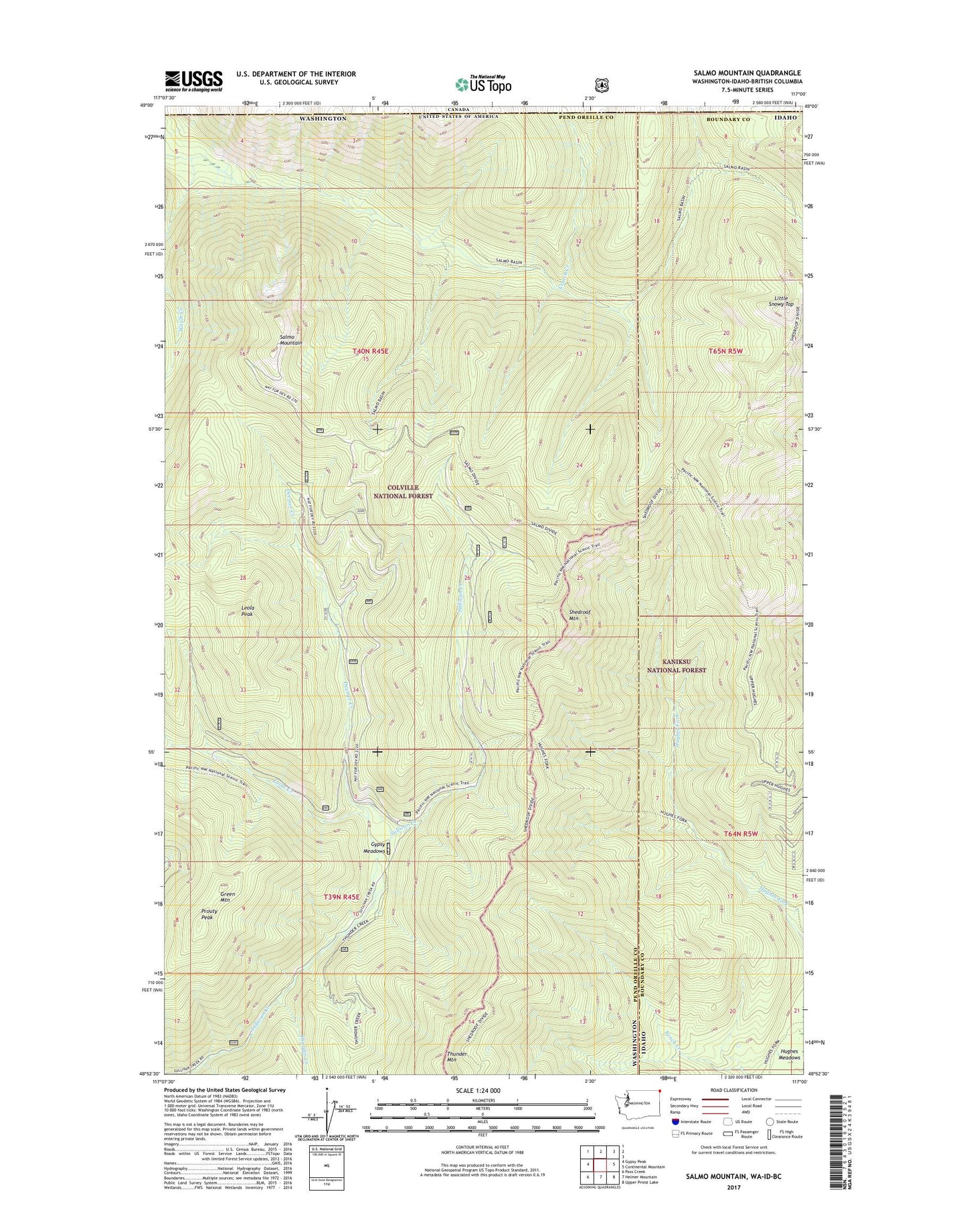
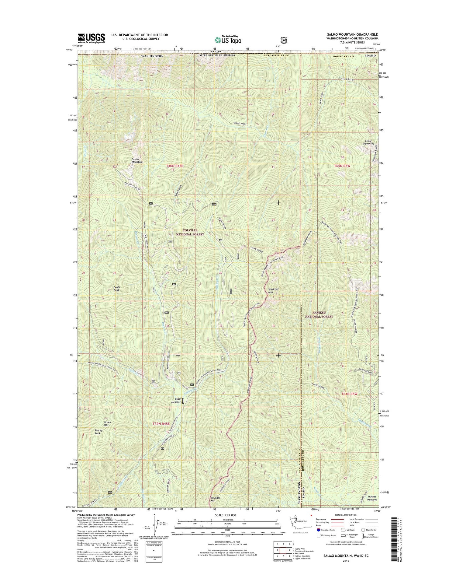
Salmo Mountain Washington US Topo Map
Couldn't load pickup availability
2020 topographic map quadrangle Salmo Mountain in the states of Washington, Idaho. Scale: 1:24000. Based on the newly updated USGS 7.5' US Topo map series, this map is in the following counties: Pend Oreille, Boundary. The map contains contour data, water features, and other items you are used to seeing on USGS maps, but also has updated roads and other features. This is the next generation of topographic maps. Printed on high-quality waterproof paper with UV fade-resistant inks.
Quads adjacent to this one:
West: Gypsy Peak
East: Continental Mountain
Southeast: Upper Priest Lake
South: Helmer Mountain
Southwest: Pass Creek
Contains the following named places: Bad River, Crutch Creek, Deemer Creek, Green Mountain, Gypsy Meadows, Leola Creek, Leola Peak, Little Snowy Top, Prouty Peak, Salmo Mountain, Salmo Mountain Research Natural Area, Shedroof Mountain, Thunder Creek, Thunder Mountain, Watch Creek