MyTopo
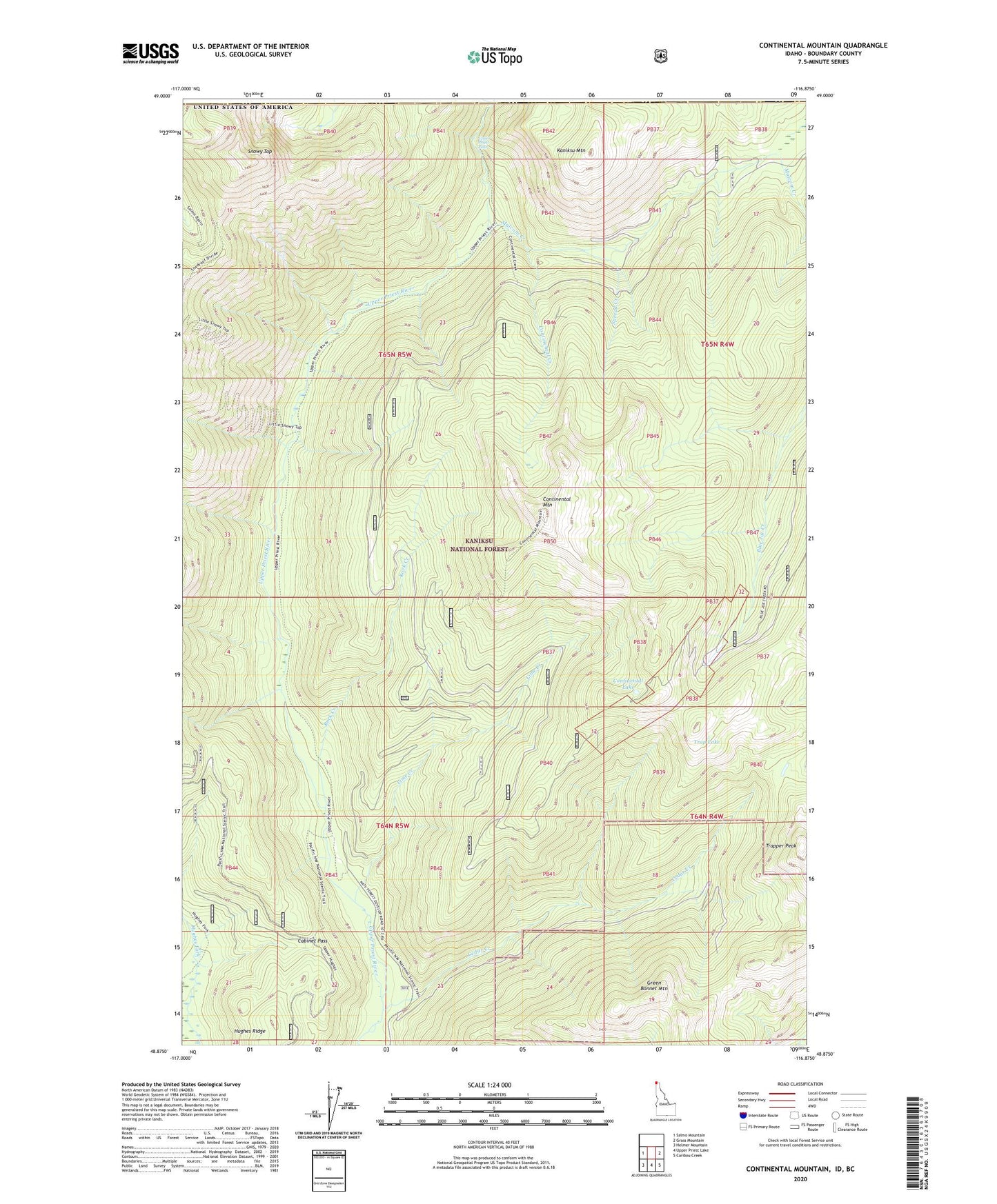
Continental Mountain Idaho US Topo Map
Couldn't load pickup availability
Also explore the Continental Mountain Forest Service Topo of this same quad for updated USFS data
2024 topographic map quadrangle Continental Mountain in the state of Idaho. Scale: 1:24000. Based on the newly updated USGS 7.5' US Topo map series, this map is in the following counties: Boundary. The map contains contour data, water features, and other items you are used to seeing on USGS maps, but also has updated roads and other features. This is the next generation of topographic maps. Printed on high-quality waterproof paper with UV fade-resistant inks.
Quads adjacent to this one:
West: Salmo Mountain
East: Grass Mountain
Southeast: Caribou Creek
South: Upper Priest Lake
Southwest: Helmer Mountain
This map covers the same area as the classic USGS quad with code o48116h8.
Contains the following named places: Cabinet Pass, Cedar Creek, Continental Creek, Continental Lake, Continental Mine, Continental Mountain, Green Bonnet Mountain, Kaniksu Mountain, Lime Creek, Malcom Creek, McLean Mine, Rock Creek, Snowy Top, Spread Creek, Trap Lake, Trapper Peak, Upper Priest Falls