MyTopo
Upper Priest Lake Idaho US Topo Map
Couldn't load pickup availability
Also explore the Upper Priest Lake Forest Service Topo of this same quad for updated USFS data
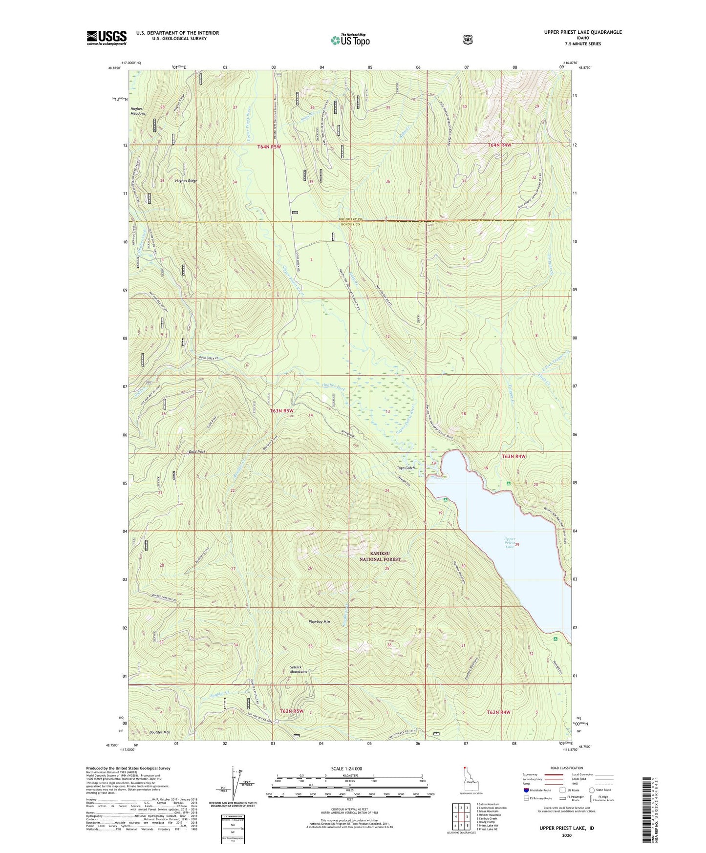
2024 topographic map quadrangle Upper Priest Lake in the state of Idaho. Scale: 1:24000. Based on the newly updated USGS 7.5' US Topo map series, this map is in the following counties: Bonner, Boundary. The map contains contour data, water features, and other items you are used to seeing on USGS maps, but also has updated roads and other features. This is the next generation of topographic maps. Printed on high-quality waterproof paper with UV fade-resistant inks.
Quads adjacent to this one:
West: Helmer Mountain
Northwest: Salmo Mountain
North: Continental Mountain
Northeast: Grass Mountain
East: Caribou Creek
Southeast: Priest Lake NE
South: Priest Lake NW
Southwest: Orwig Hump
This map covers the same area as the classic USGS quad with code o48116g8.
Contains the following named places: Boulder Creek, Boulder Mountain, Deadman Creek, East Fork Trapper Creek, Floss Creek, Gold Creek, Gold Peak, Hughes Fork, Hughes Ridge, Hughes Ridge Viewpoint, Mountain Chief Mine, Navigation Campground, Navigation Mine, Plowboy Campground, Plowboy Mine, Plowboy Mountain, Ruby Creek, Snow Creek, Togo Gulch, Trapper Creek, Upper Priest Lake, Upper Priest Lake Scenic Area, Upper Priest River