MyTopo
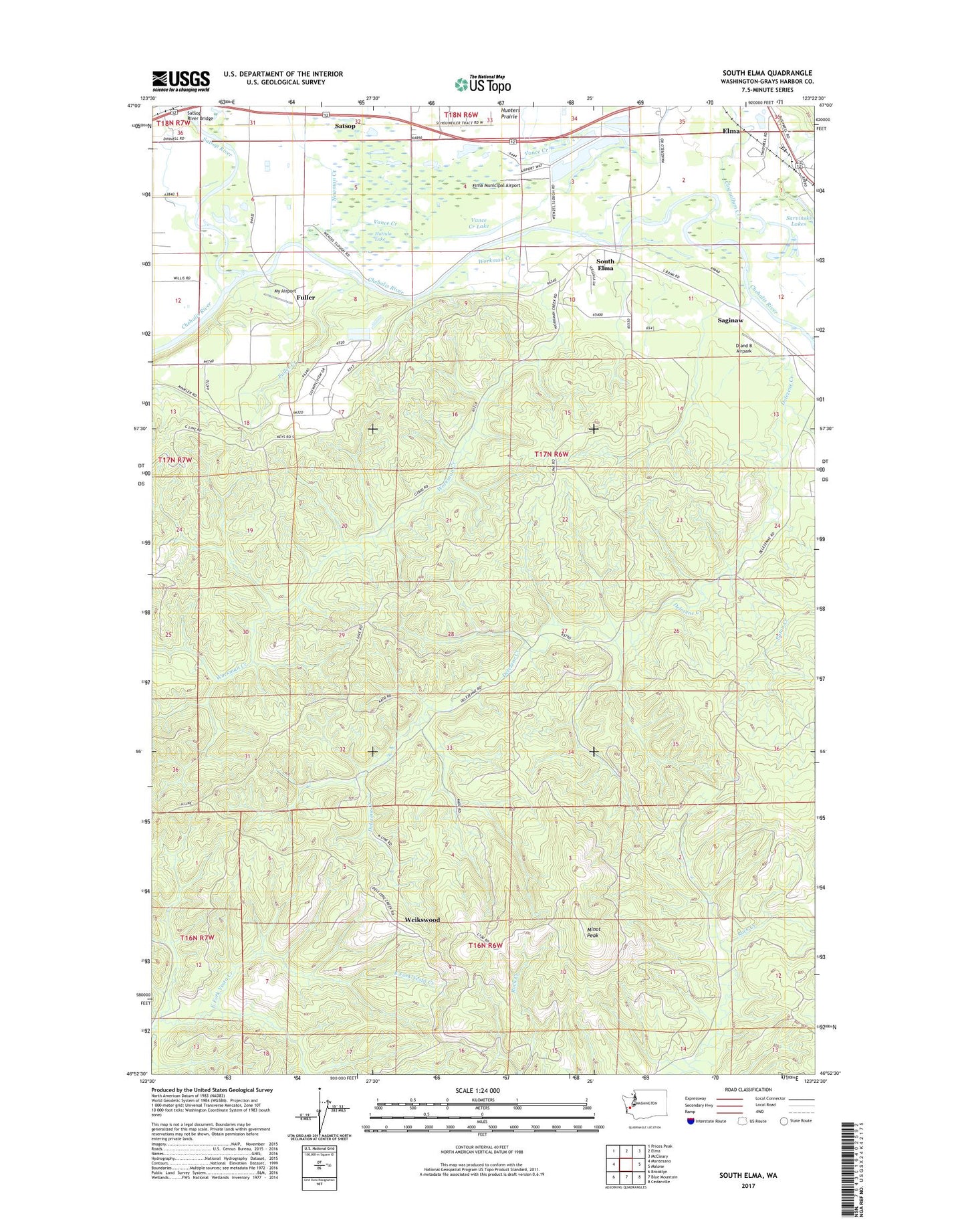
South Elma Washington US Topo Map
Couldn't load pickup availability
2020 topographic map quadrangle South Elma in the state of Washington. Scale: 1:24000. Based on the newly updated USGS 7.5' US Topo map series, this map is in the following counties: Grays Harbor. The map contains contour data, water features, and other items you are used to seeing on USGS maps, but also has updated roads and other features. This is the next generation of topographic maps. Printed on high-quality waterproof paper with UV fade-resistant inks.
Quads adjacent to this one:
West: Montesano
Northwest: Prices Peak
North: Elma
Northeast: McCleary
East: Malone
Southeast: Cedarville
South: Blue Mountain
Southwest: Brooklyn
Contains the following named places: Apostolic Wells of Living Water Church, Cloquallum Creek, D and B Airpark, Damon, Delezene Creek, Elma Municipal Airport, Elma Sewage Treatment Plant, Fuller, Fuller Creek, Grays Harbor County Fire Protection District 5 Station 54 Headquarters, Huttula Lake, KAYO-FM (Aberdeen), Minot Peak, Moores Lake, My Airport, Newman Creek, Rock Creek Truck Trail, Saginaw, Sarvinski Lakes, Satsop River, Satsop River Bridge, South Elma, Vance Creek, Vance Creek Lake, Weikswood, Wenzel Slough, Wenzel Springs Pumping Station, Winters Pit, Workman Creek