MyTopo
Montesano Washington US Topo Map
Couldn't load pickup availability
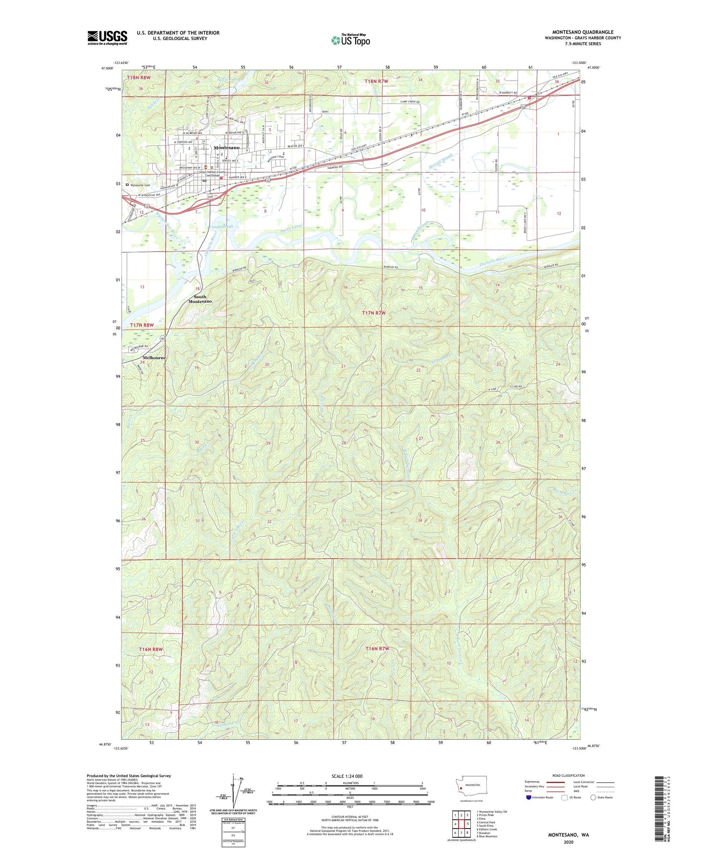
2023 topographic map quadrangle Montesano in the state of Washington. Scale: 1:24000. Based on the newly updated USGS 7.5' US Topo map series, this map is in the following counties: Grays Harbor. The map contains contour data, water features, and other items you are used to seeing on USGS maps, but also has updated roads and other features. This is the next generation of topographic maps. Printed on high-quality waterproof paper with UV fade-resistant inks.
Quads adjacent to this one:
West: Central Park
Northwest: Wynoochee Valley SW
North: Prices Peak
Northeast: Elma
East: South Elma
Southeast: Blue Mountain
South: Brooklyn
Southwest: Elkhorn Creek
This map covers the same area as the classic USGS quad with code o46123h5.
Contains the following named places: Beacon Elementary School, Brady, Calvary Chapel of Montesano, Camp Creek, Careland Playschool, Cutoff Slough, Eastgate Mobile Home Park, Elizabeth Creek, Evergreen Mobile Estates, First Baptist Church, Grays Harbor County District Court 1, Grays Harbor Fire District 2 Station 32 Brady, Grays Harbor Sheriff's Office, Landmark Apostolic Church, Metcalf Slough, Montesano, Montesano Ambulance Service, Montesano Assembly of God Church, Montesano Church of God, Montesano Fire Department, Montesano Health and Rehabilitation Center, Montesano Junior - Senior High School, Montesano Police Department, Montesano Post Office, Montesano School District 66 Office, Montesano Sewage Treatment Plant, Montesano Shopping Center, Montesano Timberland Library - W H Abel Memorial Library, Montesano United Methodist Church, Montesano Washington Presbyterian Church, Moon Slough, Saint John's Catholic Church, Saint Mark's Episcopal Church, Simpson Elementary School, Smith Canal, South Montesano, Stevens Creek, Sylvia Creek, Sylvia Lake, Sylvia Lake Dam, Wynooche Cemetery, Wynoochee River