MyTopo
Sprague Washington US Topo Map
Couldn't load pickup availability
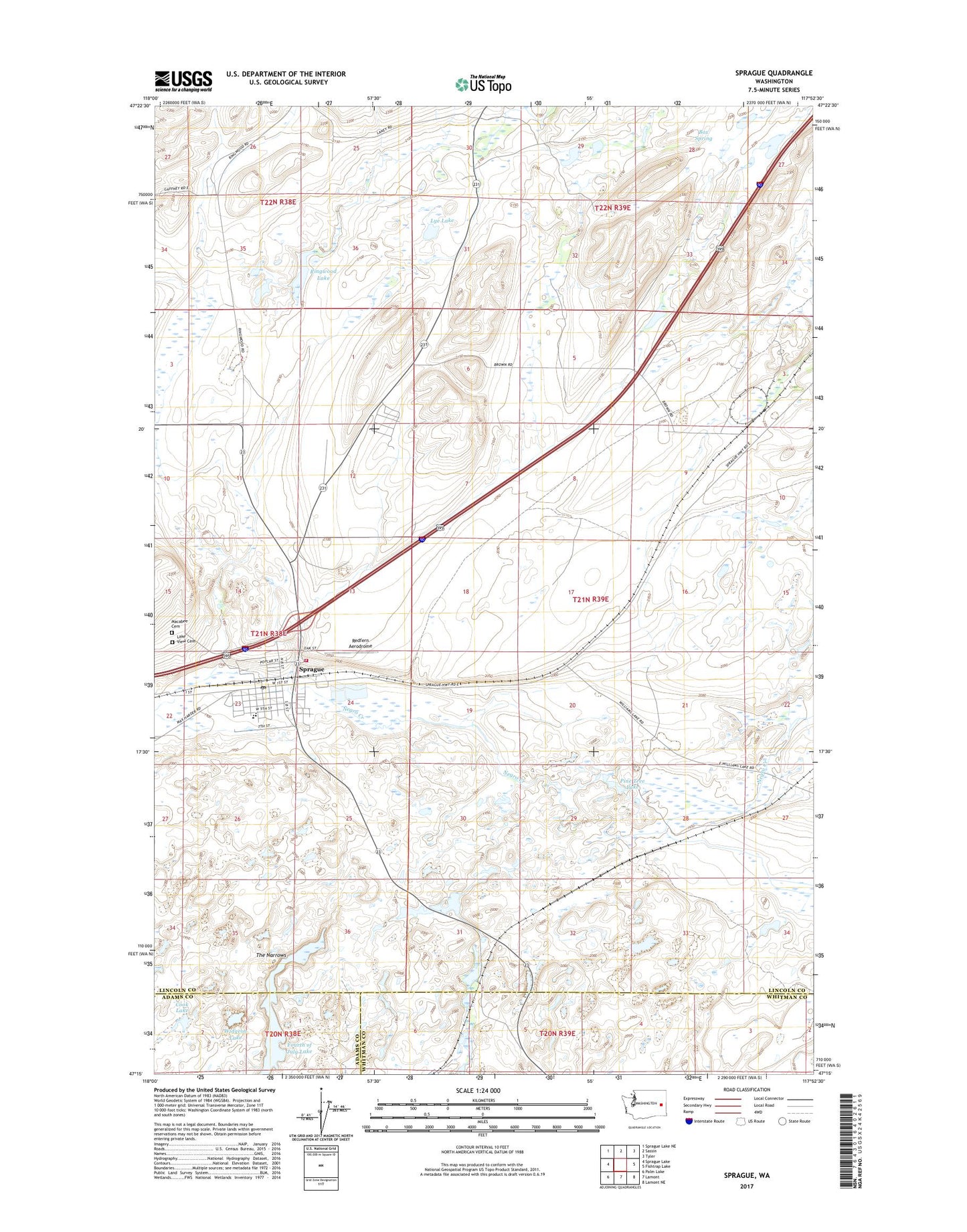
2023 topographic map quadrangle Sprague in the state of Washington. Scale: 1:24000. Based on the newly updated USGS 7.5' US Topo map series, this map is in the following counties: Lincoln, Whitman, Adams. The map contains contour data, water features, and other items you are used to seeing on USGS maps, but also has updated roads and other features. This is the next generation of topographic maps. Printed on high-quality waterproof paper with UV fade-resistant inks.
Quads adjacent to this one:
West: Sprague Lake
Northwest: Sprague Lake NE
North: Sassin
Northeast: Tyler
East: Fishtrap Lake
Southeast: Lamont NE
South: Lamont
Southwest: Palm Lake
This map covers the same area as the classic USGS quad with code o47117c8.
Contains the following named places: Box Spring, City of Sprague, Cook Lake, Fourth of July Lake, Lake View Cemetery, Lincoln County Fire District 1 Emergency Response Center, Lye Lake, Macabee Cemetery, Pine Tree Lake, Redfern Aerodrome, Ringwood Lake, Snyder Slough, Sprague, Sprague Elementary School, Sprague High School, Sprague Post Office, The Narrows, Widgeon Lake