
MyTopo
Starbuck West Washington US Topo Map
Couldn't load pickup availability
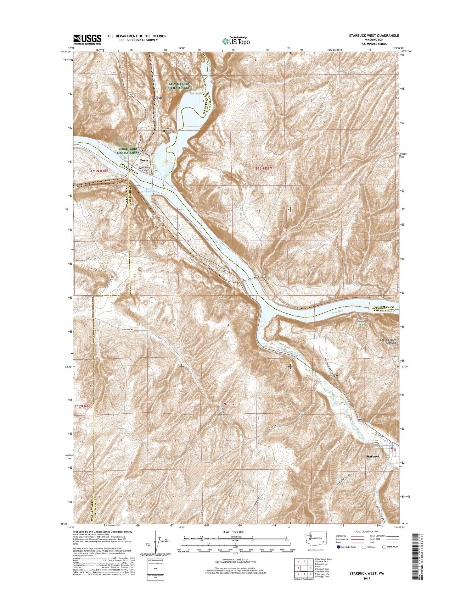
2020 topographic map quadrangle Starbuck West in the state of Washington. Scale: 1:24000. Based on the newly updated USGS 7.5' US Topo map series, this map is in the following counties: Columbia, Whitman, Franklin, Walla Walla. The map contains contour data, water features, and other items you are used to seeing on USGS maps, but also has updated roads and other features. This is the next generation of topographic maps. Printed on high-quality waterproof paper with UV fade-resistant inks.
Quads adjacent to this one:
West: Ayer
Northwest: Washtucna South
North: Palouse Falls
Northeast: Hooper Lake
East: Starbuck East
Southeast: Kellogg Creek
South: Waitsburg NW
Southwest: Pleasant View
Contains the following named places: Choke Cherry Canyon, Choke Cherry Spring, Columbia County Fire District 1, Fletcher Farm, Grange City, Joso, Kellogg Creek, Lake Herbert G West Reservation Area, Lyons Dam, Lyons Ferry, Lyons Ferry Bridge, Lyons Ferry Fish Hatchery, Lyons Ferry Marina, Lyons Ferry State Park, Marmes Rock Shelter, Old Bones Cemetery, Palouse River, Perry, Powers, Starbuck, Starbuck Post Office, Tucannon, Tucannon River, Tucker Farm


