MyTopo
Palouse Falls Washington US Topo Map
Couldn't load pickup availability
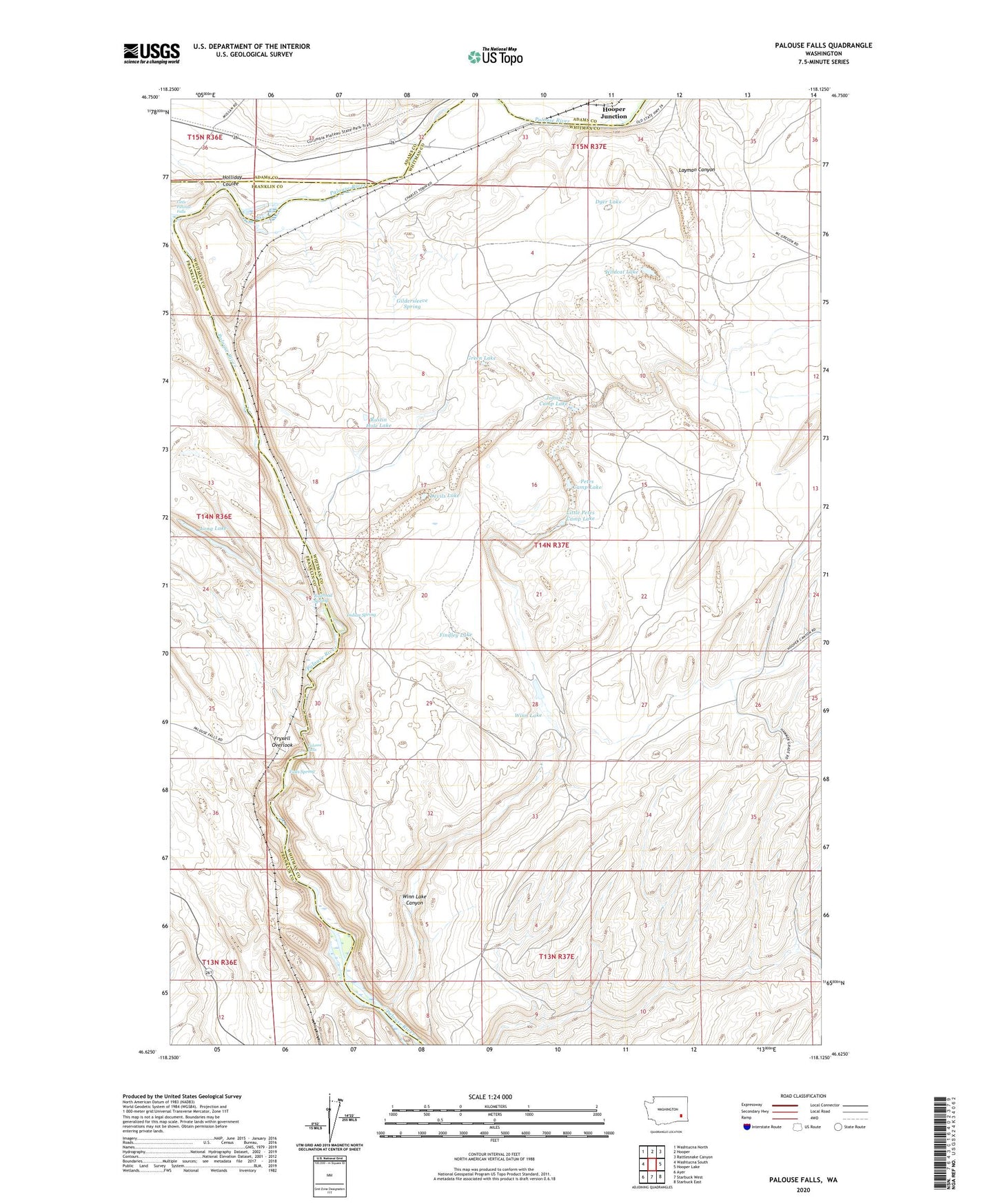
2023 topographic map quadrangle Palouse Falls in the state of Washington. Scale: 1:24000. Based on the newly updated USGS 7.5' US Topo map series, this map is in the following counties: Whitman, Franklin, Adams. The map contains contour data, water features, and other items you are used to seeing on USGS maps, but also has updated roads and other features. This is the next generation of topographic maps. Printed on high-quality waterproof paper with UV fade-resistant inks.
Quads adjacent to this one:
West: Washtucna South
Northwest: Washtucna North
North: Hooper
Northeast: Rattlesnake Canyon
East: Hooper Lake
Southeast: Starbuck East
South: Starbuck West
Southwest: Ayer
This map covers the same area as the classic USGS quad with code o46118f2.
Contains the following named places: Devils Lake, Dyer Lake, Falls Spring, Findley Lake, Fryxell Overlook, Gildersleeve Spring, Green Lake, Holliday Coulee, Indian Spring, Johns Camp Lake, Layman Canyon, Little Palouse Falls, Little Petes Camp Lake, Long Lake, McGregor, McGregor Lakes, McGregory Dam, Palouse Falls, Palouse Falls State Park, Park, Petes Camp Lake, Railroad Spring, Rustin Hole Lake, Wildcat Lake, Winn Lake, Winn Lake Canyon, ZIP Code: 99333