MyTopo
Touchet Washington US Topo Map
Couldn't load pickup availability
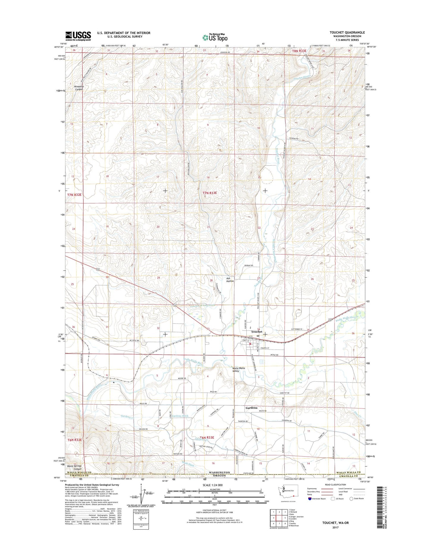
2020 topographic map quadrangle Touchet in the state of Washington. Scale: 1:24000. Based on the newly updated USGS 7.5' US Topo map series, this map is in the following counties: Walla Walla, Umatilla. The map contains contour data, water features, and other items you are used to seeing on USGS maps, but also has updated roads and other features. This is the next generation of topographic maps. Printed on high-quality waterproof paper with UV fade-resistant inks.
Quads adjacent to this one:
West: Zangar Junction
Northwest: Slater
North: Welland
Northeast: Rulo
East: Lowden
Southeast: Waterman
South: Smeltz
Southwest: Ring
Contains the following named places: Ash Hollow, Gardena, Gardena Creek, Gardena Ditch, Mousser Hall Ditch, Pine Creek, Touchet, Touchet Census Designated Place, Touchet Division, Touchet East Side Ditch, Touchet Elementary and High School, Touchet Junior-Senior High School, Touchet Post Office, Touchet River, Touchet West Side Ditch, Walla Walla County Fire District 6, ZIP Code: 99360