MyTopo
Lowden Washington US Topo Map
Couldn't load pickup availability
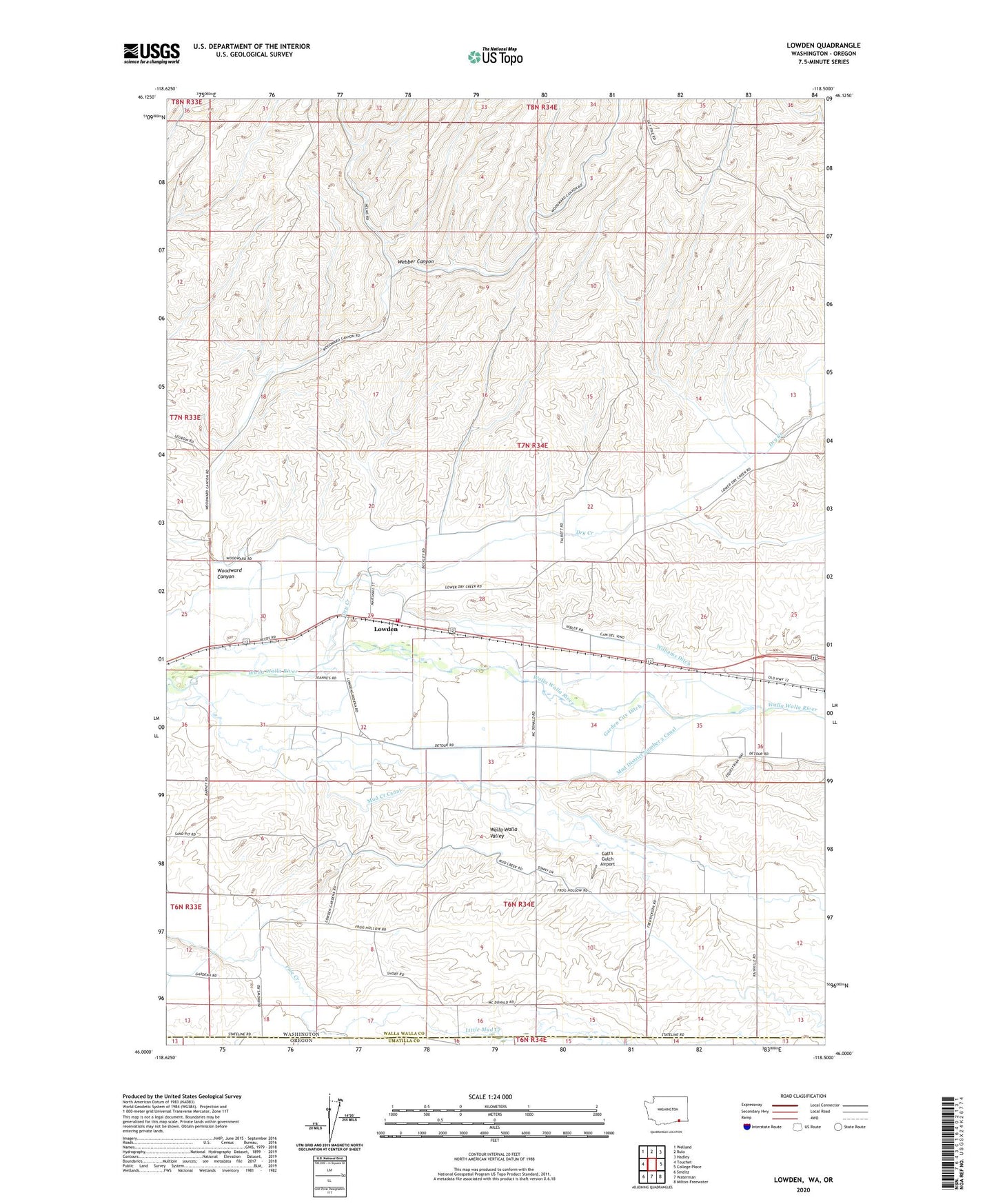
2023 topographic map quadrangle Lowden in the state of Washington. Scale: 1:24000. Based on the newly updated USGS 7.5' US Topo map series, this map is in the following counties: Walla Walla, Umatilla. The map contains contour data, water features, and other items you are used to seeing on USGS maps, but also has updated roads and other features. This is the next generation of topographic maps. Printed on high-quality waterproof paper with UV fade-resistant inks.
Quads adjacent to this one:
West: Touchet
Northwest: Welland
North: Rulo
Northeast: Hadley
East: College Place
Southeast: Milton-Freewater
South: Waterman
Southwest: Smeltz
This map covers the same area as the classic USGS quad with code o46118a5.
Contains the following named places: Burlingame Ditch, Demaris Ditch, Dry Creek, Frenchtown Monument, Galt's Gulch Airport, Garden City Ditch, Hill Top, Little Mud Creek, Lowden, Mud Creek, Mud Creek Canal, Mud District Number 2 Canal, Mud District Number 7 Canal, Short Low Ditch, Walla Walla County Fire District 6, Webber Canyon, Whitman Ditch, Williams Ditch, Woodward Canyon