MyTopo
Waterman Oregon US Topo Map
Couldn't load pickup availability
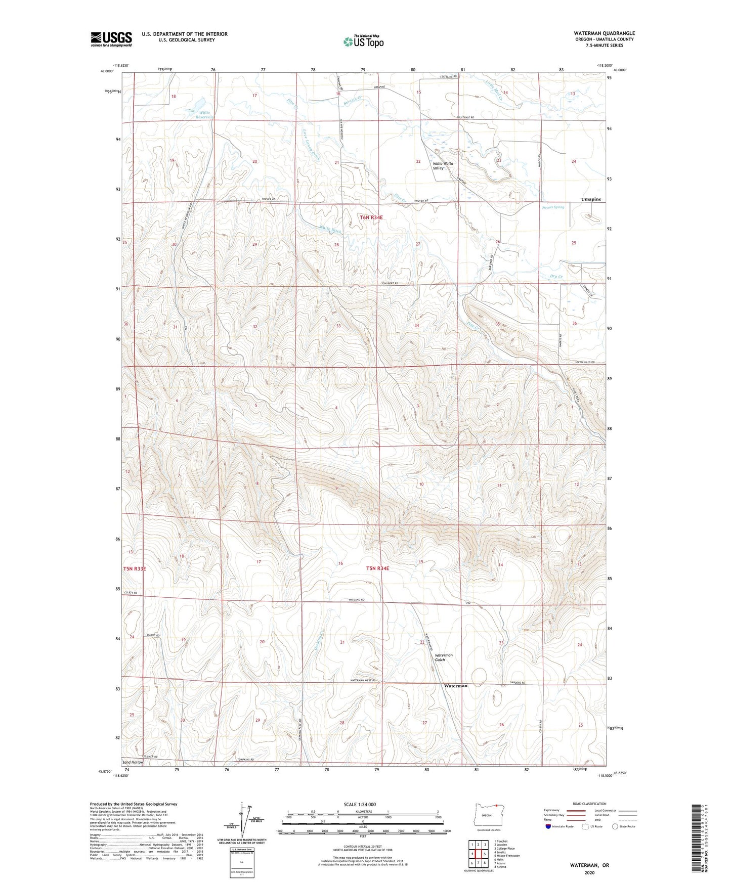
2023 topographic map quadrangle Waterman in the state of Oregon. Scale: 1:24000. Based on the newly updated USGS 7.5' US Topo map series, this map is in the following counties: Umatilla. The map contains contour data, water features, and other items you are used to seeing on USGS maps, but also has updated roads and other features. This is the next generation of topographic maps. Printed on high-quality waterproof paper with UV fade-resistant inks.
Quads adjacent to this one:
West: Smeltz
Northwest: Touchet
North: Lowden
Northeast: College Place
East: Milton-Freewater
Southeast: Athena
South: Adams
Southwest: Helix
This map covers the same area as the classic USGS quad with code o45118h5.
Contains the following named places: Athena Division, Burley Creek, Dry Creek, Dugger Creek, Duroc, Love Loney Ditch, Swartz Creek, Swartz Spring, Umapine Census Designated Place, Waterman, Wayland, White Ditch, White Reservoir