MyTopo
Waitsburg Washington US Topo Map
Couldn't load pickup availability
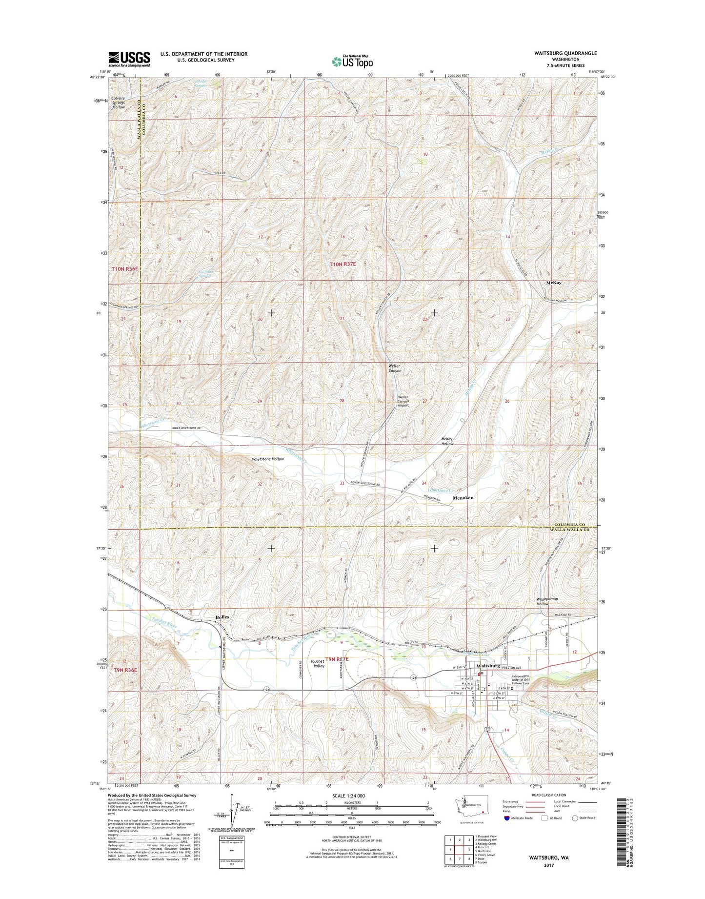
2020 topographic map quadrangle Waitsburg in the state of Washington. Scale: 1:24000. Based on the newly updated USGS 7.5' US Topo map series, this map is in the following counties: Columbia, Walla Walla. The map contains contour data, water features, and other items you are used to seeing on USGS maps, but also has updated roads and other features. This is the next generation of topographic maps. Printed on high-quality waterproof paper with UV fade-resistant inks.
Quads adjacent to this one:
West: Prescott
Northwest: Pleasant View
North: Waitsburg NW
Northeast: Kellogg Creek
East: Huntsville
Southeast: Coppei
South: Dixie
Southwest: Valley Grove
Contains the following named places: Bolles, Bruce Memorial Museum, City of Waitsburg, Coppei Creek, Fountain Springs, Independent Order of Odd Fellows Cemetery, McKay, McKay Hollow, Menoken, Preston Park, Waitsburg, Waitsburg Ambulance Service, Waitsburg Elementary School, Waitsburg Fire Department, Waitsburg High School, Waitsburg Junction, Waitsburg Post Office, Waitsburg Upper Elementary School, Weller Canyon, Weller Canyon Airport, Whoopemup Hollow, Wilson Creek