MyTopo
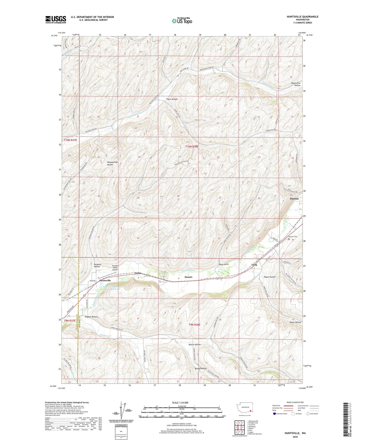
Huntsville Washington US Topo Map
Couldn't load pickup availability
2023 topographic map quadrangle Huntsville in the state of Washington. Scale: 1:24000. Based on the newly updated USGS 7.5' US Topo map series, this map is in the following counties: Columbia, Walla Walla. The map contains contour data, water features, and other items you are used to seeing on USGS maps, but also has updated roads and other features. This is the next generation of topographic maps. Printed on high-quality waterproof paper with UV fade-resistant inks.
Quads adjacent to this one:
West: Waitsburg
Northwest: Waitsburg NW
North: Kellogg Creek
Northeast: Tucannon
East: Dayton
Southeast: Robinette Mountain
South: Coppei
Southwest: Dixie
This map covers the same area as the classic USGS quad with code o46118c1.
Contains the following named places: Bundy Hollow, Columbia School, Dayton Lumber Company Mill Dam, Dayton Lumber Company Mill Pond, Dumas, Dustin Hollow, Hogeye Hollow, Huntsville, Lewis, Lewis and Clark Trail State Park, Long, Payne Hollow, Pioneer Cemetery, Rose Gulch, Sorghum Hollow, Thorn Hollow, Touchet Valley Airport, Varna, Whisky Creek