MyTopo
Willy Dick Canyon Washington US Topo Map
Couldn't load pickup availability
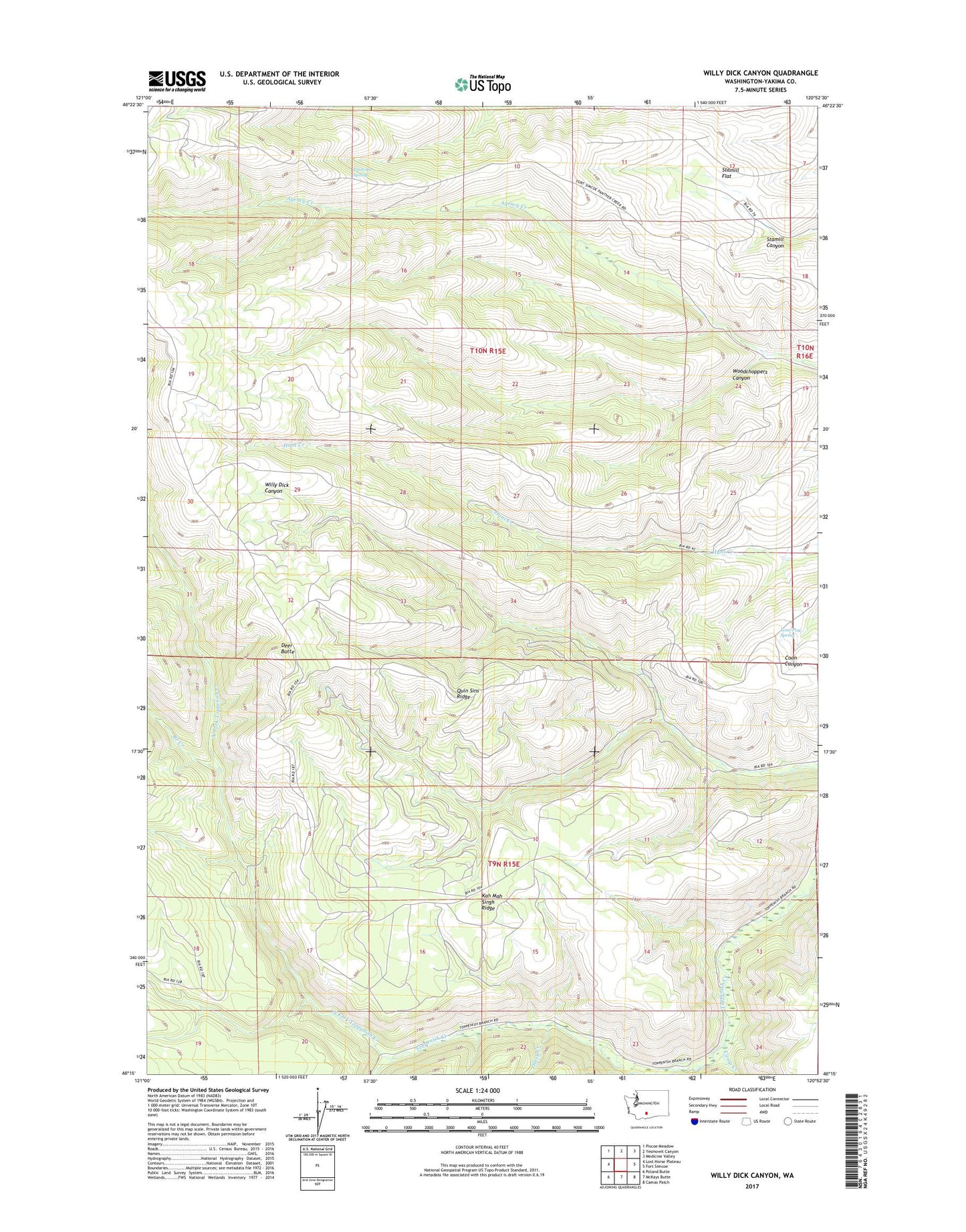
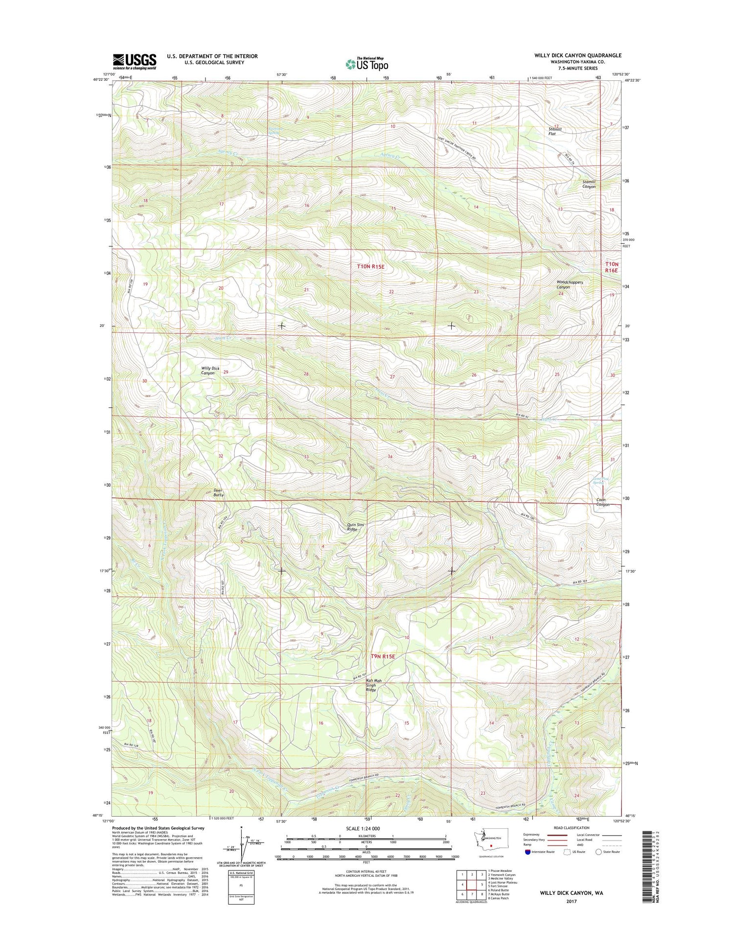
2020 topographic map quadrangle Willy Dick Canyon in the state of Washington. Scale: 1:24000. Based on the newly updated USGS 7.5' US Topo map series, this map is in the following counties: Yakima. The map contains contour data, water features, and other items you are used to seeing on USGS maps, but also has updated roads and other features. This is the next generation of topographic maps. Printed on high-quality waterproof paper with UV fade-resistant inks.
Quads adjacent to this one:
West: Lost Horse Plateau
Northwest: Piscoe Meadow
North: Yesmowit Canyon
Northeast: Medicine Valley
East: Fort Simcoe
Southeast: Camas Patch
South: McKays Butte
Southwest: Poland Butte
Contains the following named places: Branch Creek, Camp Creek, Clock Creek, Deer Butte, Fairview Spring, Kah Mah Singh Ridge, Lone Pine Spring, North Fork Toppenish Creek, Olney Creek, Quin Sins Ridge, Stamill Flat, Wild Horse Corral, Willy Dick Crossing, Woodchoppers Canyon