MyTopo
Poland Butte Washington US Topo Map
Couldn't load pickup availability
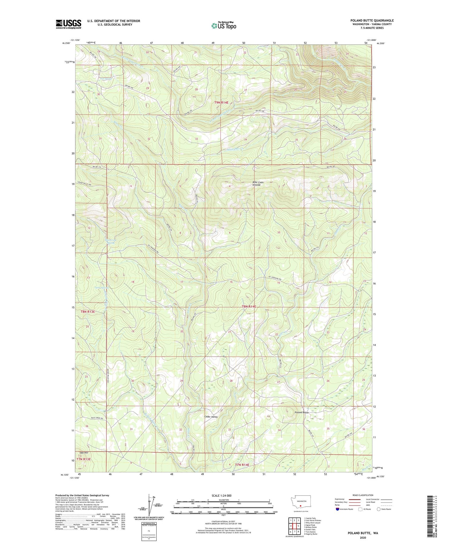
2023 topographic map quadrangle Poland Butte in the state of Washington. Scale: 1:24000. Based on the newly updated USGS 7.5' US Topo map series, this map is in the following counties: Yakima. The map contains contour data, water features, and other items you are used to seeing on USGS maps, but also has updated roads and other features. This is the next generation of topographic maps. Printed on high-quality waterproof paper with UV fade-resistant inks.
Quads adjacent to this one:
West: Signal Peak
Northwest: Castile Falls
North: Lost Horse Plateau
Northeast: Willy Dick Canyon
East: McKays Butte
Southeast: Hagerty Butte
South: Twin Buttes
Southwest: Outlet Falls
This map covers the same area as the classic USGS quad with code o46121b1.
Contains the following named places: Lost Springs, Lost Springs Campground, Lyon Spring, Mike Coon Hillside, Oak Hill, Poland Butte, Shamrock Spring, South Fork Toppenish Creek, Tepee Creek, West Fork White Creek