MyTopo
Center Point West Virginia US Topo Map
Couldn't load pickup availability
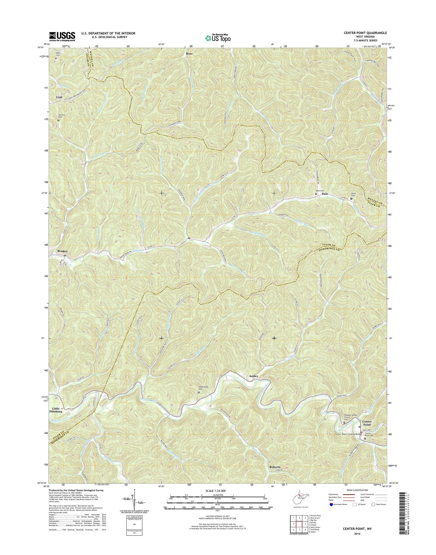
2023 topographic map quadrangle Center Point in the state of West Virginia. Scale: 1:24000. Based on the newly updated USGS 7.5' US Topo map series, this map is in the following counties: Doddridge, Tyler, Wetzel. The map contains contour data, water features, and other items you are used to seeing on USGS maps, but also has updated roads and other features. This is the next generation of topographic maps. Printed on high-quality waterproof paper with UV fade-resistant inks.
Quads adjacent to this one:
West: Shirley
Northwest: Porters Falls
North: Pine Grove
Northeast: Big Run
East: Folsom
Southeast: Salem
South: Smithburg
Southwest: West Union
This map covers the same area as the classic USGS quad with code o39080d6.
Contains the following named places: Allen School, Alvy Post Office, Anderson Fork, Ashley, Beartree Run, Bethel Chapel, Big Battle Run, Bonelick Run, Braden, Broad Run, Broad Run School, Buffalo Run School, Bunker Run, Cale Run, Campbell Run, Center Point, Center Point Cemetery, Center Point Christian Church, Center Point Covered Bridge, Center Point Post Office, Dale, Davis Run, Elklick Run, Elklick School, Flint Run, Franks Run, Golden Don School, Grass Spring Run, Indian Run, Laughery Fork, Lefthand Fork Stackpole Run, Lima Post Office, Link, Little Battle Run, Little Flint Run, Little Pittsburg, Lower Franks Run School, Lower Riggins Run School, Lyons Cemetery, Lyons School, Main Cemetery, McClellan Volunteer Fire Department, McIntyre Fork, Melburn School, Mountain State Academy, Oakland School, Parks Cemetery, Pike Fork, Pleasant Baptist Cemetery, Pleasant Baptist Church, Ralphs Run, Riggins Run, Roberts, Robinson Fork, Ross, Ross School, Shadeland School, Stackpole Run, Stringtown, Sunfish Run, Talkington Fork, Tennant Cemetery, Underwood Cemetery, Walnut Fork, Walnut Fork Church, Walnut Fork School, ZIP Codes: 26377, 26419