MyTopo
Glengary West Virginia US Topo Map
Couldn't load pickup availability
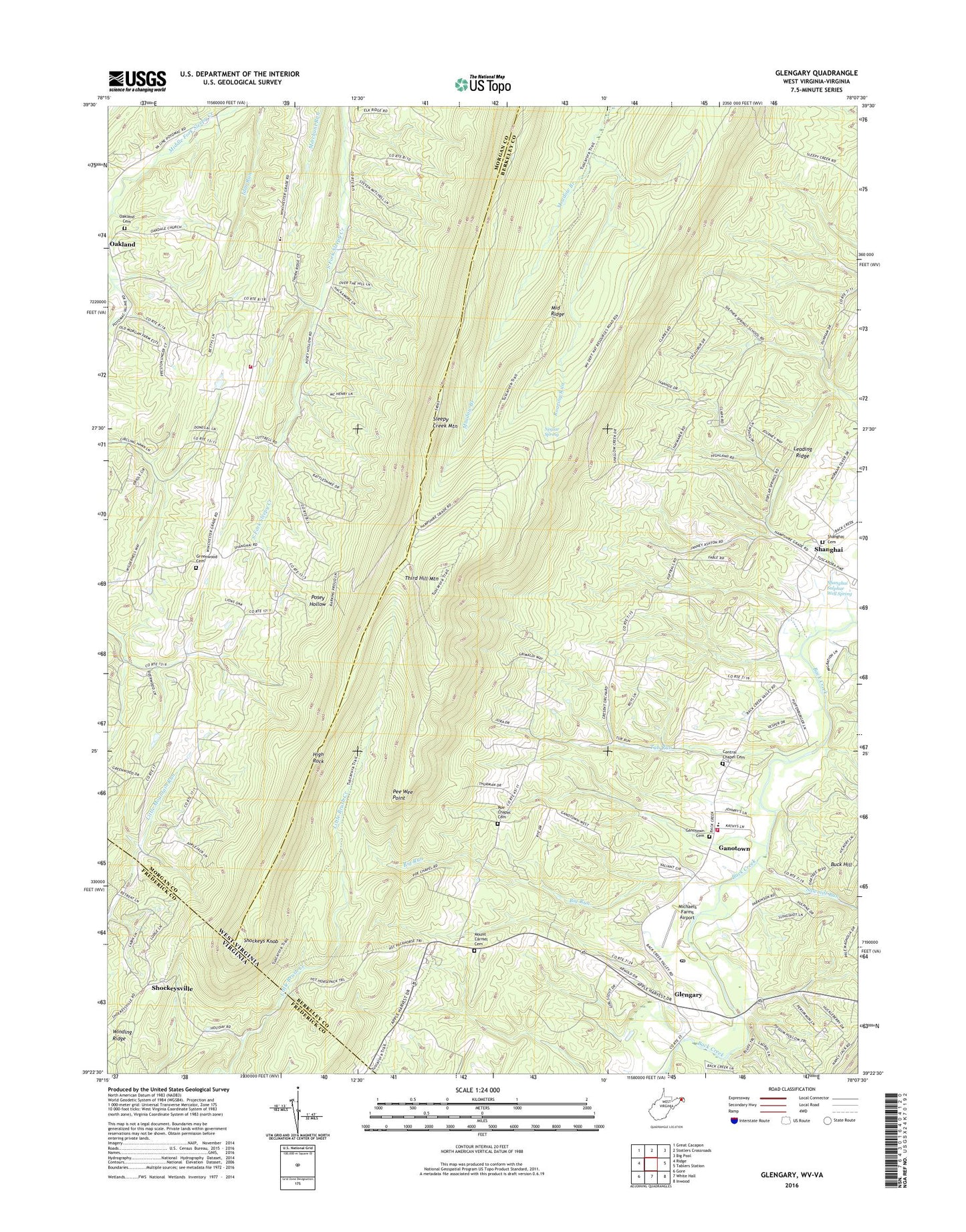
2019 topographic map quadrangle Glengary in the states of West Virginia, Virginia. Scale: 1:24000. Based on the newly updated USGS 7.5' US Topo map series, this map is in the following counties: Berkeley, Morgan, Frederick. The map contains contour data, water features, and other items you are used to seeing on USGS maps, but also has updated roads and other features. This is the next generation of topographic maps. Printed on high-quality waterproof paper with UV fade-resistant inks.
Quads adjacent to this one:
West: Ridge
Northwest: Great Cacapon
North: Stotlers Crossroads
East: Tablers Station
Southeast: Inwood
South: White Hall
Southwest: Gore
Contains the following named places: Back Creek Valley Elementary School, Back Creek Valley Volunteer Fire Department, Berkeley County Emergency Ambulance Authority 50, Big Run, Central Chapel Cemetery, Central Church, Ganotown, Ganotown Cemetery, Ganotown Methodist Church, Glengary, Glengary Post Office, Greenwood, Greenwood Cemetery, Greenwood Elementary School, Greenwood School, Greenwood United Methodist Church, High Rock, Leading Ridge, Locks-of-the-Mountain, Michaels Farms Airport, Middle Ridge, Morgan County Observatory, Mount Carmel Cemetery, Mount Carmel Church, Neglar Spring, New Hope School, Oakland Cemetery, Oakland School, Oakland United Methodist Church, Pee Wee Point, Pine Ridge Camp, Piney Grove School, Roaring Run, Roe Chapel, Roe Chapel Cemetery, Sawmill Run, Shanghai, Shanghai Presbyterian Cemetery, Shanghai Presbyterian Church, Shanghai School, Shanghai Sulphur Well Spring, Shockeys Knob, Shockeysville, Shockeysville United Methodist Church, Sleepy Creek Mountain, South Morgan Volunteer Fire Department, Sulphur Spring School, Third Hill Mountain, Tub Run, Winding Ridge