MyTopo
Glover Gap West Virginia US Topo Map
Couldn't load pickup availability
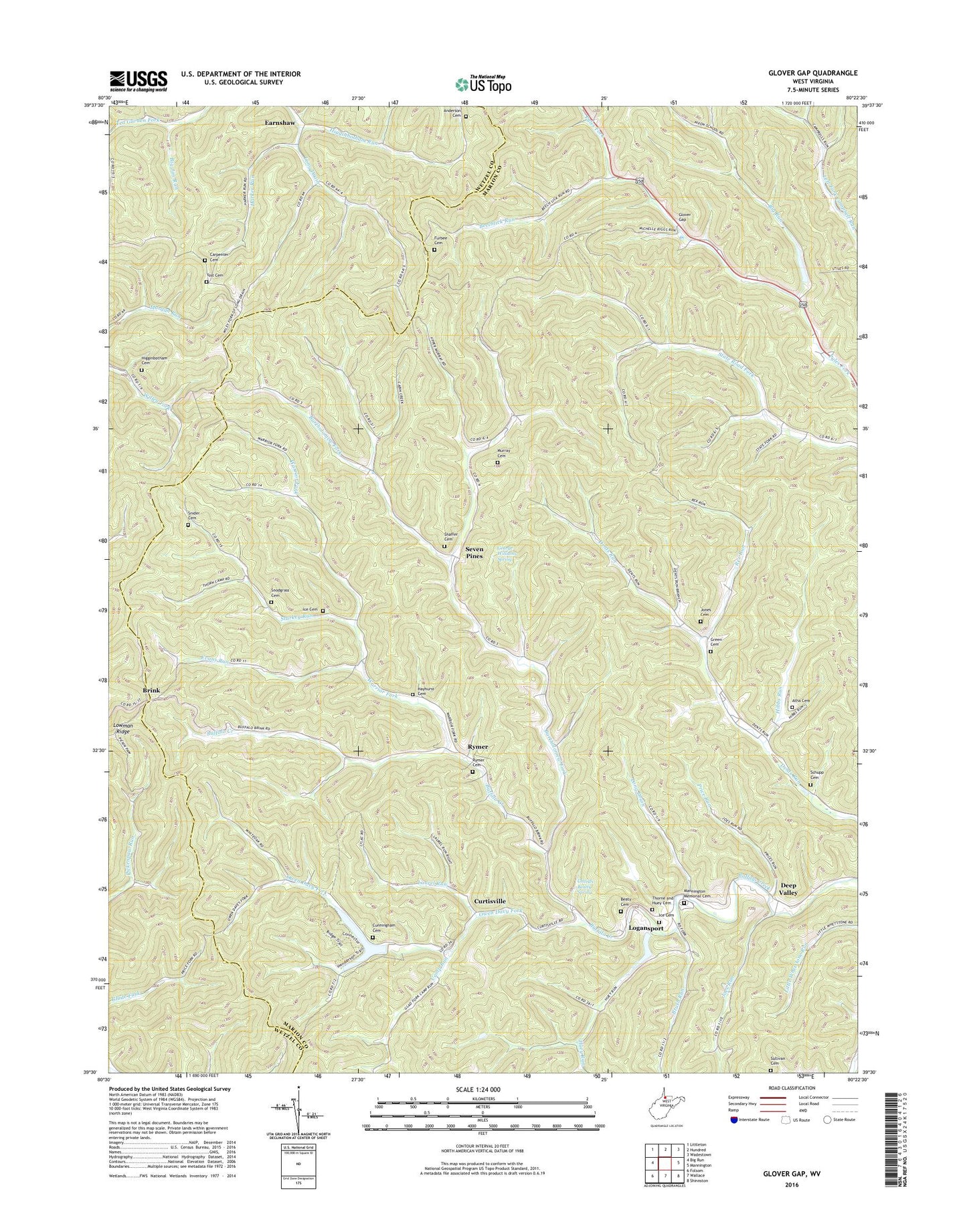
2019 topographic map quadrangle Glover Gap in the state of West Virginia. Scale: 1:24000. Based on the newly updated USGS 7.5' US Topo map series, this map is in the following counties: Marion, Wetzel. The map contains contour data, water features, and other items you are used to seeing on USGS maps, but also has updated roads and other features. This is the next generation of topographic maps. Printed on high-quality waterproof paper with UV fade-resistant inks.
Quads adjacent to this one:
West: Big Run
Northwest: Littleton
North: Hundred
Northeast: Wadestown
East: Mannington
Southeast: Shinnston
South: Wallace
Southwest: Folsom
Contains the following named places: Anderson Cemetery, Atha Cemetery, Bartholomew Fork, Beaty Cemetery, Beechlick Run, Big Jim Run, Big Run, Brink, Brush Run, Camp Run, Carpenter Cemetery, Centenary Church, Charles Beatty Spring, Cunningham Cemetery, Cunningham School, Curtis Church, Curtisville, Deep Valley, Dents Run Church, Earnshaw, Evans Run, Evergreen Church, Furbee Cemetery, Furbee School, George Williams Spring, Glover Gap, Glover Gap Church, Glover Gap School, Green Cemetery, Harker Run, Hayhurst Cemetery, Hibbs Run, Higginbotham Cemetery, Higginbotham Run, Huey Run, Huey Run School, Ice Cemetery, Joes Run, Jones Cemetery, Laurel Run, Logansport, Logansport United Methodist Church, Long Drain, Mannington Memorial Cemetery, Metz School, Murray Cemetery, Murray School, Myers Chapel, Owen Davy Fork, Price Run, Rex Run, Rymer, Rymer Cemetery, Rymer United Methodist Church, Satterfield, Schupp Cemetery, Seven Pines, Shaffer Cemetery, Snider Cemetery, Snodgrass Cemetery, Snodgrass School, Starkey Run, State Road School, Sullivan Cemetery, The Little Red Church, Thorne and Huey Cemetery, Upper Buffalo Creek Structure Number 22 Dam, Upper Buffalo Creek Structure Number Two Dam, Upper Dents Run School, Warrior Fork, West School, Whetstone A M D Dam, White School, Yost Cemetery, ZIP Codes: 26582, 26585