MyTopo
Littleton West Virginia US Topo Map
Couldn't load pickup availability
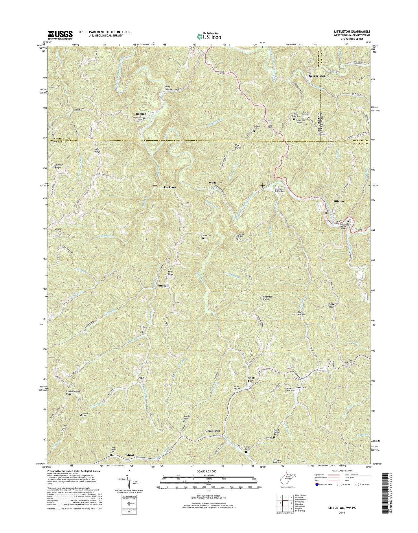
2023 topographic map quadrangle Littleton in the states of West Virginia, Pennsylvania. Scale: 1:24000. Based on the newly updated USGS 7.5' US Topo map series, this map is in the following counties: Wetzel, Marshall, Greene. The map contains contour data, water features, and other items you are used to seeing on USGS maps, but also has updated roads and other features. This is the next generation of topographic maps. Printed on high-quality waterproof paper with UV fade-resistant inks.
Quads adjacent to this one:
West: Wileyville
Northwest: Glen Easton
North: Cameron
Northeast: New Freeport
East: Hundred
Southeast: Glover Gap
South: Big Run
Southwest: Pine Grove
This map covers the same area as the classic USGS quad with code o39080f5.
Contains the following named places: Amos Hollow, Anderson Bethel Cemetery, Anthem, Bannen, Bat Run, Bear Run, Bear Run School, Beaverdam School, Bellton Mill School, Board Tree, Board Tree Cemetery, Board Tree Tunnel, Camp Run, Carney Cemeteries, Carney Fork, Carney Fork Church, Cliff Run, Coon Run, Crooked Run, Dean, Denver Heights, Denver Heights School, Dewey School, East View Cemetery, East View Church, East View School, Endicott, Fall Run, Fall Run-Wild Cat Hollow School, Fanlight School, Georgetown, Green Valley School, Hays School, Hickman Run, Horner Cemetery, Hutches Cemetery, Isaac Run, Johnson Ridge, Jolliffee Cemetery, Kirk Ridge, Kirk Ridge Church, Knob Fork, Knob Run, Liston Hollow, Liston School, Little Laurel Run, Littleton, Littleton Cemetery, Littleton Census Designated Place, Littleton Church of God, Littleton Post Office, Long Drain, Long Valley Cemetery, Long Valley Church, Low Gap Cemetery, Low Gap Church, Martin Tunnel, McCabe Cemetery, McCabe Church, Meadowdale Cemetery, Meadowdale Church, Miller Chapel, Miller Fork, Miller Ridge, Miller Run, Moore Cemetery, Morris Cemetery, Morris Run, Morris Run Church, Morris Run School, Mount Herman Cemetery, Mount Hermon Church, Mount Zion Cemetery, Mount Zion Church, Mudlick Run, Potts School, Rice Ridge, Rice School, Ride Ridge Church, Ridge Ridge Cemetery, Robinson Ridge, Robinson Ridge Church, Robinson Ridge School, Rockport, Rocky Run, Stottlemire Run, Strosnider Hill Cemetery, Sugar Grove School, Sugar Run, Tan Trough Run, Uniontown, Wade, Wade Cemetery, Walnut Grove School, Wheat, White Run, Windy Ridge, Wolf Run, ZIP Code: 26581