MyTopo
Middlebourne West Virginia US Topo Map
Couldn't load pickup availability
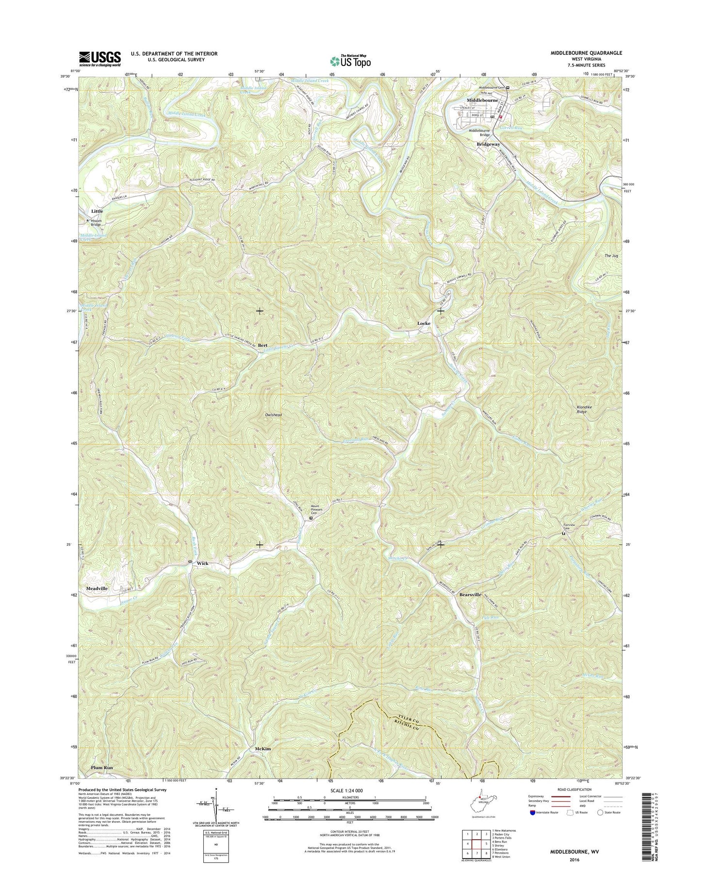
2023 topographic map quadrangle Middlebourne in the state of West Virginia. Scale: 1:24000. Based on the newly updated USGS 7.5' US Topo map series, this map is in the following counties: Tyler, Ritchie. The map contains contour data, water features, and other items you are used to seeing on USGS maps, but also has updated roads and other features. This is the next generation of topographic maps. Printed on high-quality waterproof paper with UV fade-resistant inks.
Quads adjacent to this one:
West: Bens Run
Northwest: New Matamoras
North: Paden City
Northeast: Porters Falls
East: Shirley
Southeast: West Union
South: Pennsboro
Southwest: Ellenboro
This map covers the same area as the classic USGS quad with code o39080d8.
Contains the following named places: Archers Chapel, Ash Church, Ash School, Bearsville, Bert, Bridgeway, Buffalo Run, Cabin Run, Davis Run, Ellsworth Middle School, Fairview Church, Fairview Church Cemetery, Fairview School, Foster Run, Freeland Run, Golden Down School, Gorrell Run, Gorrell School, Grimms Run, Hissom Bridge, Hopewell School, Jug Run, Jug Run School, Klondike Ridge, Lawson Church, Little, Little Sancho Creek, Locke, McKim, Middlebourne, Middlebourne - Tyler County Volunteer Fire Department, Middlebourne Bridge, Middlebourne Cemetery, Middlebourne Post Office, Mount Pleasant Cemetery, Mountain View School, Next, Owlshead, Pleasant Dale School, Pyle Run, Rock Run, Rose Run, Rush Fork, Rush Fork School, Sancho, Sancho Creek, South Fork Sugar Creek, Stewart Fork, Stewart Run, The Jug, Town of Middlebourne, Tyler County, Tyler County Courthouse, Tyler County Emergency Medical Services Unit 1 Station 70, Tyler County High School, Tyler County Jail, Tyler County Public Library, Tyler County Sheriff's Office, Walnut Run, Walnut Run School, Wick, Wick Post Office