MyTopo
Moatstown West Virginia US Topo Map
Couldn't load pickup availability
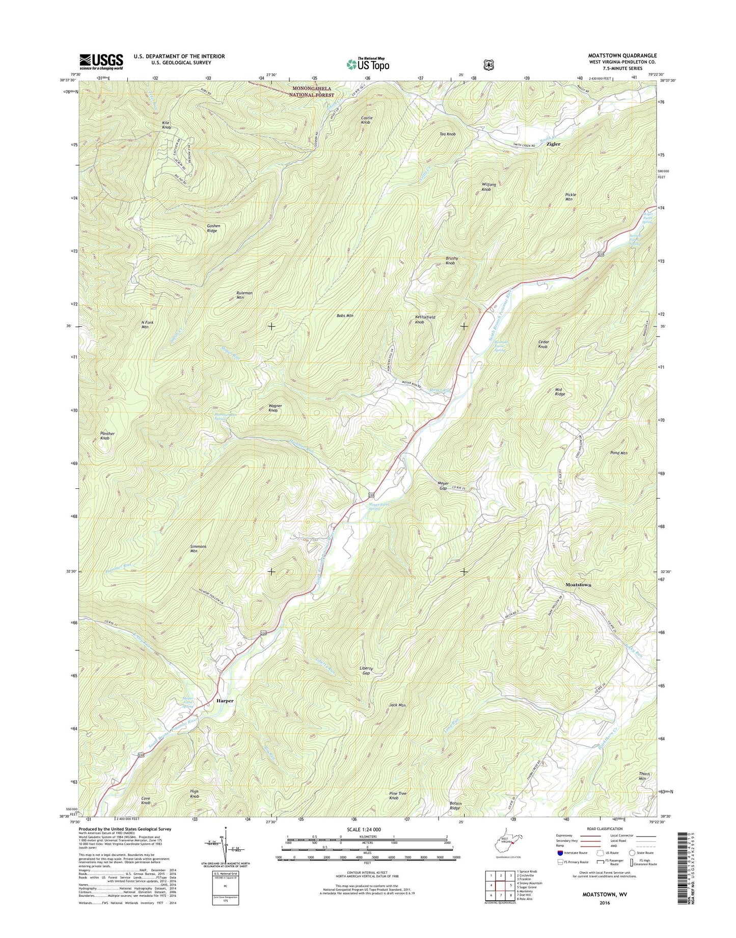
2019 topographic map quadrangle Moatstown in the state of West Virginia. Scale: 1:24000. Based on the newly updated USGS 7.5' US Topo map series, this map is in the following counties: Pendleton. The map contains contour data, water features, and other items you are used to seeing on USGS maps, but also has updated roads and other features. This is the next generation of topographic maps. Printed on high-quality waterproof paper with UV fade-resistant inks.
Quads adjacent to this one:
West: Snowy Mountain
Northwest: Spruce Knob
North: Circleville
Northeast: Franklin
East: Sugar Grove
South: Doe Hill
Southwest: Monterey
Contains the following named places: Big Run, Bobs Mountain, Brushy Knob, Castle Knob, Cave, Cedar Knob, Central District, Cove Knob, East Dry Run, Goshen Ridge, Gravel Lick Run, Hammer Run, Hammer Run Spring, Harper, High Knob, Kettlefield Knob, Kile Knob, Liberty Gap, Liberty Run, Little Creek, Long Run, Middle Ridge, Moatstown, Moyer Farm Spring, Moyer Gap, Moyer Run, North Fork Mountain, Panther Knob, Pickle Mountain, Pine Tree Knob, Pond Mountain, Rexrode Farm Spring, Ruleman Mountain, Saint Johns Church, Sandy Ridge Church, Sennett Farm Spring, Simmons Mountain, Smith Creek Church, Tea Knob, Wagner Knob, Wilfong Knob, Zigler