MyTopo
Snowy Mountain West Virginia US Topo Map
Couldn't load pickup availability
Also explore the Snowy Mountain Forest Service Topo of this same quad for updated USFS data
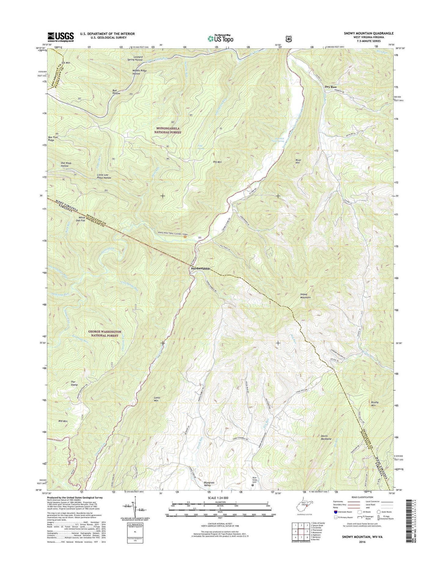
2023 topographic map quadrangle Snowy Mountain in the states of West Virginia, Virginia. Scale: 1:24000. Based on the newly updated USGS 7.5' US Topo map series, this map is in the following counties: Pendleton, Highland, Pocahontas. The map contains contour data, water features, and other items you are used to seeing on USGS maps, but also has updated roads and other features. This is the next generation of topographic maps. Printed on high-quality waterproof paper with UV fade-resistant inks.
Quads adjacent to this one:
West: Thornwood
Northwest: Sinks of Gandy
North: Spruce Knob
Northeast: Circleville
East: Moatstown
Southeast: Doe Hill
South: Monterey
Southwest: Hightown
This map covers the same area as the classic USGS quad with code o38079e5.
Contains the following named places: Bee Tree Ridge, Big Mountain, Big Mountain Trail, Blue Grass, Blue Grass Cemetery, Bluegrass Valley, Brushy Mountain, Buck Run, Bud Hollow, Christian Run, Christian Run Trail, Cold Spring, Cold Spring Run, Devils Backbone, Dry Run, Dry Run Church, East Dry Run Church, Elk Mountain Chapel, Hardscrabble, Hemlock Run, Hendrick Farm Spring, Knotmaul Run, Laurel Fork, Laurel Fork Trail, Leonard Spring Hollow, Little Low Place Hollow, Locust Spring Run, Middle Mountain, Middle Mountain Trail, Middle Ridge Hollow, New Church, North Fork Church, Owl Knob Hollow, River Hill, Sams Run, Sawmill Branch, Slabcamp Run, Snowy Mountain, Straight Fork, Swank Chapel, Teeter Camp Run, The Stamp, Vance Run, White Oak Flat, ZIP Codes: 24413, 26804