MyTopo
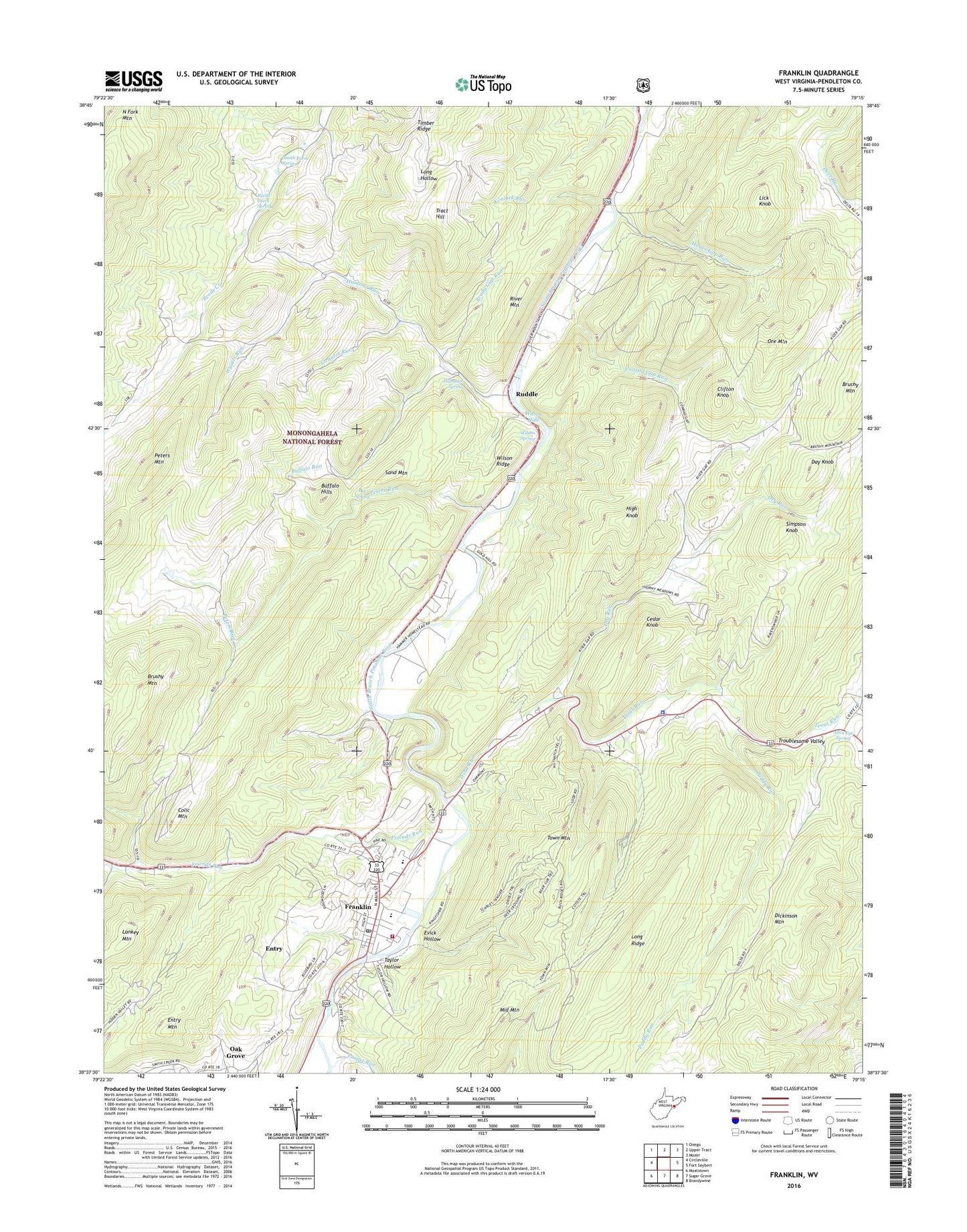
Franklin West Virginia US Topo Map
Couldn't load pickup availability
Also explore the Franklin Forest Service Topo of this same quad for updated USFS data
2023 topographic map quadrangle Franklin in the state of West Virginia. Scale: 1:24000. Based on the newly updated USGS 7.5' US Topo map series, this map is in the following counties: Pendleton. The map contains contour data, water features, and other items you are used to seeing on USGS maps, but also has updated roads and other features. This is the next generation of topographic maps. Printed on high-quality waterproof paper with UV fade-resistant inks.
Quads adjacent to this one:
West: Circleville
Northwest: Onego
North: Upper Tract
Northeast: Mozer
East: Fort Seybert
Southeast: Brandywine
South: Sugar Grove
Southwest: Moatstown
This map covers the same area as the classic USGS quad with code o38079f3.
Contains the following named places: Allen Eye Spring, Big Spring, Brady Gap Run, Brushy Mountain, Buffalo Hills, Buffalo Run, Cedar Knob, Clifton Knob, Colic Mountain, Conrad Gap Run, Day Knob, Dry Run, Entry, Entry Mountain, Evick Hollow, Franklin, Franklin Elementary School, Franklin Post Office, Franklin Volunteer Fire Department, Friends Run, Hammer Run, Hammer Spring, Hayes Gap Run, High Knob, Kentuck Run, Lankey Mountain, Laurel Hill Church, Lick Knob, Long Ridge, Middle Mountain, Oak Grove, Ore Mountain, Paddy Run, Pendleton County, Pendleton County Courthouse, Pendleton County Emergency Rescue Franklin, Pendleton County Middle / High School, Pendleton County Public Library, Pendleton County Sheriff's Office, Peters Run, Propst Run, Reeds Creek Church, Reeds Creek Spring, River Mountain, Ruddle, Ruddle Church, Sand Mountain, Simpson Knob, Smith Farm Spring, Strauter Run, Taylor Hollow, Timber Ridge, Town Mountain, Town of Franklin, Tract Hill, Troublesome Valley, Trout Run, West Virginia State Police Troop 3 - Franklin Detachment, Wilson Hole, Wilson Ridge, Wilson Spring, Wyatts Run, ZIP Code: 26807