MyTopo
Mud West Virginia US Topo Map
Couldn't load pickup availability
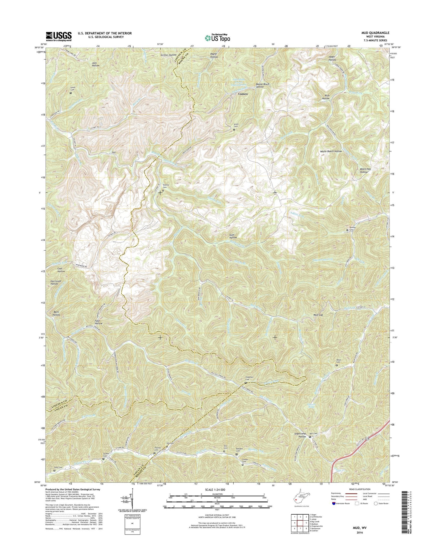
2019 topographic map quadrangle Mud in the state of West Virginia. Scale: 1:24000. Based on the newly updated USGS 7.5' US Topo map series, this map is in the following counties: Boone, Lincoln, Logan. The map contains contour data, water features, and other items you are used to seeing on USGS maps, but also has updated roads and other features. This is the next generation of topographic maps. Printed on high-quality waterproof paper with UV fade-resistant inks.
Quads adjacent to this one:
West: Big Creek
Northwest: Hager
North: Griffithsville
Northeast: Julian
East: Madison
Southeast: Clothier
South: Henlawson
Southwest: Chapmanville
Contains the following named places: Adkins Fork, Antill Cemetery, Baisden Cemetery, Baisden Fork, Ballard Fork, Barn Hollow, Bearcamp Branch, Bell Cemetery, Berry Branch, Berry Branch Church, Berry Branch School, Big Deadening Creek, Black Hog Hollow, Boone Block Hollow, Bragg Fork, Cameo, Chandler School, Chapman Branch, Chapman Cemetery, Connelly Branch, Connelly School, Cox Fork, Dollie, Dollie School, Dry Branch, Duty Cemetery, Duval District, Elk Lick, Ellis Cemetery, Ellis Fork, Estep, Fawn Hollow, Fowler Cemetery, Fowler Fork, Glovers Pond, Grassy Fork, Grider Fork, Gum Hollow, Hager Hollow, Harmon Branch, Hill Cemetery, Horse Branch, Huntingcamp Branch, Jack Smith Branch Impoundment, Jack Smith Branch Refuse Bank Dam, Jule Fork, Lavender Fork, Left Fork Ballard Fork, Left Fork Long Branch, Lick Creek Church, Lick Creek School, Little Deadening Creek, Lukey Fork, Miller Cemetery, Miller School, Mud, Mud Gap, Mud School, Mullins Branch, North Fork Church, North Fork School, Passenger Fork, Payne Hollow, Pigeonroost Fork, Rich Hollow, Right Fork Long Branch, Righthand Fork Cox Creek, Rushpatch Branch, Sally Fork, Sanders Branch, Skinned Poplar Branch, Smith Cemetery, Spring Branch, Spruce Lick, Stanley Cemetery, Stanley Fork, Stonecoal Branch, Sugarcamp Hollow, Sugartree Branch, Tawney Cemetery, Thomas Cemetery, Thomas School, Trace Branch, Twin Branch, Vickers Cemetery, White Beech Hollow, ZIP Codes: 25053, 25203, 25565