MyTopo
Griffithsville West Virginia US Topo Map
Couldn't load pickup availability
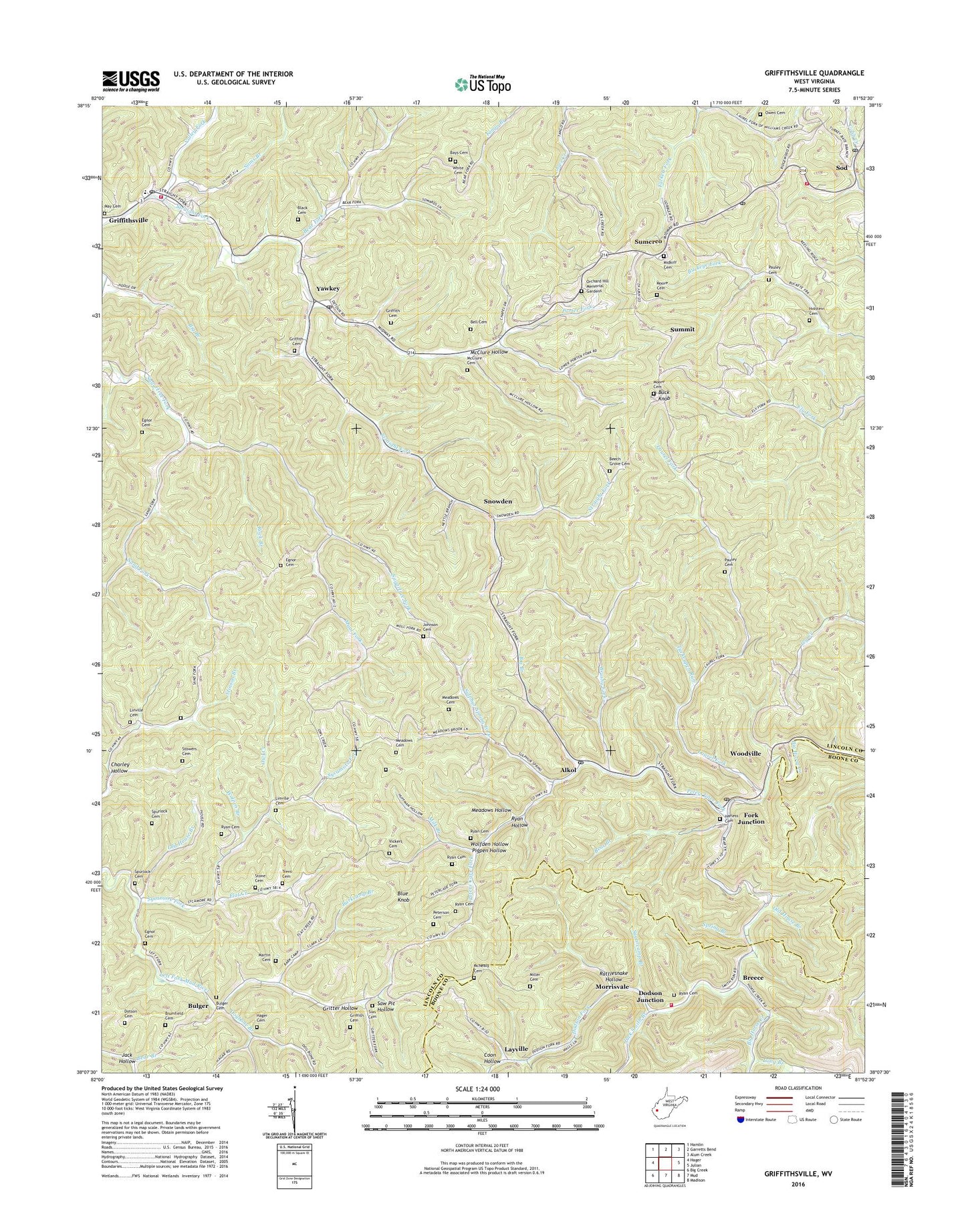
2023 topographic map quadrangle Griffithsville in the state of West Virginia. Scale: 1:24000. Based on the newly updated USGS 7.5' US Topo map series, this map is in the following counties: Lincoln, Boone. The map contains contour data, water features, and other items you are used to seeing on USGS maps, but also has updated roads and other features. This is the next generation of topographic maps. Printed on high-quality waterproof paper with UV fade-resistant inks.
Quads adjacent to this one:
West: Hager
Northwest: Hamlin
North: Garretts Bend
Northeast: Alum Creek
East: Julian
Southeast: Madison
South: Mud
Southwest: Big Creek
This map covers the same area as the classic USGS quad with code o38081b8.
Contains the following named places: Alkol, Alkol Post Office, Alum Creek Volunteer Fire Department Station 3, Barkcamp Branch, Bays Cemetery, Bear Branch, Bear Fork, Beech Grove Cemetery, Beech Grove Church, Bell Cemetery, Big Branch, Black Cemetery, Blue Knob, Breece, Brumfield Cemetery, Brushy Fork, Brushy Fork School, Buck Knob, Buck Knob Lookout Tower, Bulger, Bulger Cemetery, Bulger School, Charley Hollow, Church of Christ, Cobb Creek Church, Coon Hollow, District 1, Dodson Fork, Dodson Junction, Dogbone Branch, Dotson Cemetery, Duval District Volunteer Fire Department, Duval High School, Duval PK - 8 School, East, Eden Church, Egnor Cemetery, Ely School, Flat Creek, Fork Junction, Griffith Cemetery, Griffithsville, Griffithsville Elementary School, Griffithsville Post Office, Gritter Hollow, Hager Cemetery, Harless Cemetery, Holstein Cemetery, Jack Hollow, Jack Smith Branch, Johnson Cemetery, Laurel Fork, Layville, Left Fork Church, Lincoln Emergency Medical Services Yawkey Substation, Linville Cemetery, Long Branch, Martin Cemetery, Martin School, Maul Fork, Maul Fork School, May Cemetery, McClure Cemetery, McClure Hollow, McNealy Cemetery, Meadows Cemetery, Meadows Hollow, Midkiff Cemetery, Milk Branch, Miller Cemetery, Moore Cemetery, Morrisvale, Morrisvale School, Morrisvale Volunteer Fire Department, Old House Branch, Orchard Hill Memorial Gardens, Owen Cemetery, Owl Creek, Pauley Cemetery, Peters Cave Fork, Peterson Cemetery, Pigpen Hollow, Porter Fork, Porter Fork Church, Rattlesnake Hollow, Rock Branch, Ryan Cemetery, Ryan Hollow, Sams Branch, Sand Fork, Sand Fork Church, Sand Fork School, Sandy Gap Church of God, Saw Pit Hollow, Sias Cemetery, Snowden, Sod, Sod Church, Sod Post Office, Spring Branch, Spurlock Cemetery, Stinson School, Stone Cemetery, Stowers Cemetery, Sugarcamp Branch, Sulphur Spring Fork, Sumerco, Sumerco Church, Sumerco Post Office, Summit, Sycamore Fork, Sycamore Grove Church, Tackett Fork, Trent Cemetery, Turkeypen Run, Upper Buckeye School, Valley Fork, Vickers Cemetery, White Cemetery, Wolfden Hollow, Wolpen Branch, Woodville, Woodville Post Office, Woodville School, Yawkey, Yawkey Post Office, Yawkey United Methodist Church, ZIP Codes: 25501, 25521, 25573