MyTopo
Quick West Virginia US Topo Map
Couldn't load pickup availability
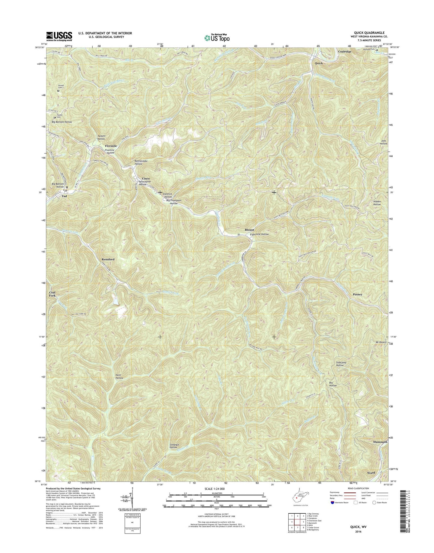
2019 topographic map quadrangle Quick in the state of West Virginia. Scale: 1:24000. Based on the newly updated USGS 7.5' US Topo map series, this map is in the following counties: Kanawha. The map contains contour data, water features, and other items you are used to seeing on USGS maps, but also has updated roads and other features. This is the next generation of topographic maps. Printed on high-quality waterproof paper with UV fade-resistant inks.
Quads adjacent to this one:
West: Charleston East
Northwest: Big Chimney
North: Blue Creek
Northeast: Clendenin
East: Mammoth
Southeast: Montgomery
South: Cedar Grove
Southwest: Belle
Contains the following named places: Annfred, Big Bottom Hollow, Big Bottom Missionary Baptist Church, Big Ninemile Fork, Big Tenmile Fork, Big Thompson Hollow, Blount, Blount Post Office, Book Fork, Cinco, Cline Branch, Coalridge, Counterfeit Branch, Eightmile Fork, Eightmile Hollow, Fivemile, Fivemile Fork, Fivemile Hollow, Grace Church, Hansel School, Hunt Hollow, Hunter Cemetery, Hunter Cemetery 2, Jims Fork, Kennedy Cemetery, Little Ninemile Fork, Little Tenmile Fork, Little Ugly Branch, Mary Ingles Elementary School, Mount Desert, Mount Desert Lookout Tower, Patterson Cemetery, Perryville Church, Pigeonroost Fork, Pointlick School, Quick, Rattlesnake Hollow, Rensford, Right Fork Mill Creek, Schoolhouse Fork, Slack Branch, Slatelick Hollow, Slatelick Run, Sprucepine Hollow, Steepgut Hollow, Tackett Hollow, Tad, Tad Post Office, Tenmile School, Ugly Branch, Whiteoak Fork, ZIP Codes: 25025, 25201, 25306