
MyTopo
Wallace West Virginia US Topo Map
Couldn't load pickup availability
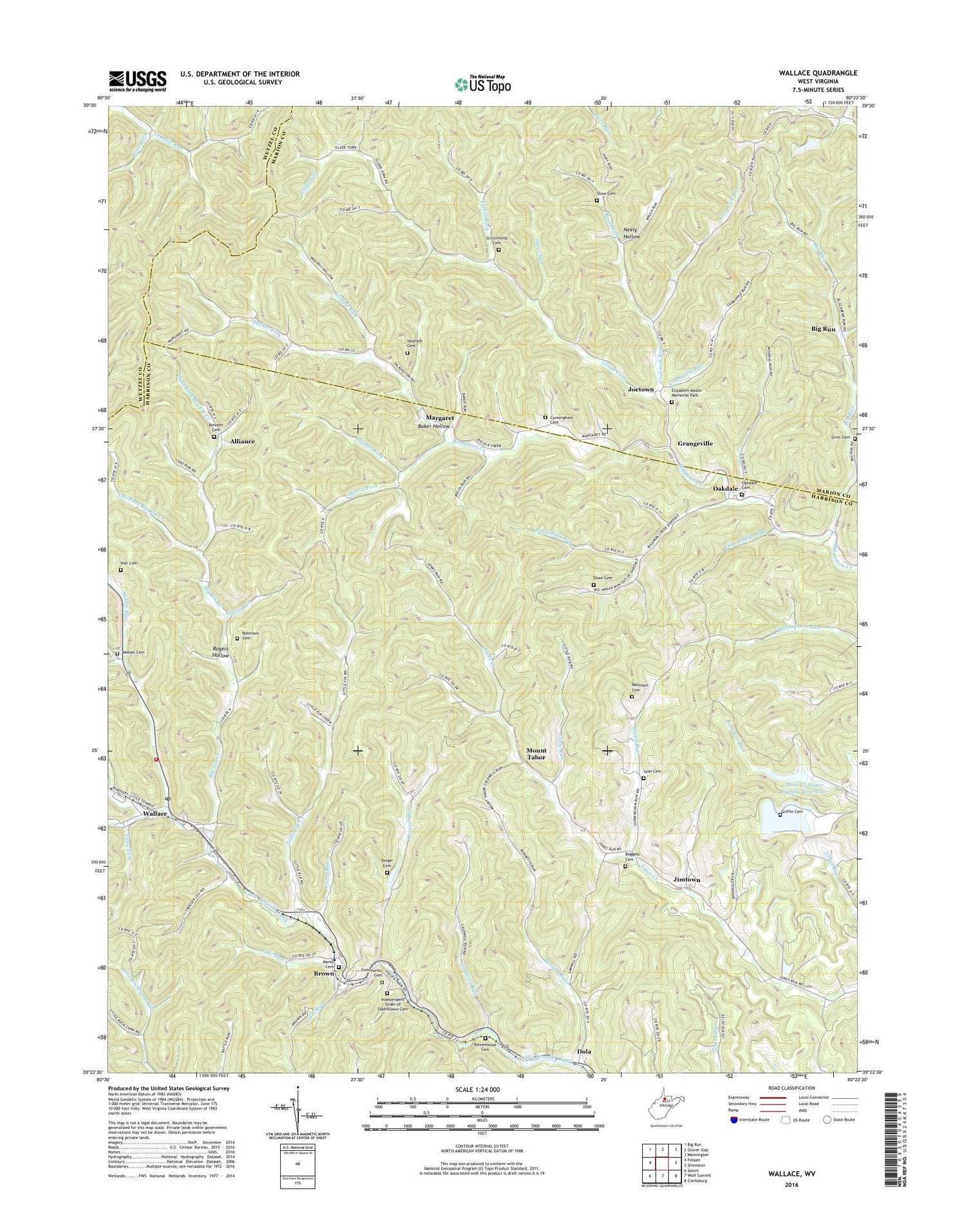
2019 topographic map quadrangle Wallace in the state of West Virginia. Scale: 1:24000. Based on the newly updated USGS 7.5' US Topo map series, this map is in the following counties: Harrison, Marion, Wetzel. The map contains contour data, water features, and other items you are used to seeing on USGS maps, but also has updated roads and other features. This is the next generation of topographic maps. Printed on high-quality waterproof paper with UV fade-resistant inks.
Quads adjacent to this one:
West: Folsom
Northwest: Big Run
North: Glover Gap
Northeast: Mannington
East: Shinnston
Southeast: Clarksburg
South: Wolf Summit
Southwest: Salem
Contains the following named places: Alliance, Baker Hollow, Barnes Run, Bennett Cemetery, Bennett Run, Bethany Baptist Church, Bethel Church, Big Elk Creek, Big Indian Run, Big Run, Bingamon Church, Boggess Cemetery, Brown, Caldwell Run, Caldwell School, Camp Run, Coal Lick Run, Coal Lick School, Community Cemetery, Crabapple Run, Cunningham Cemetery, Dola, Duncan School, Elizabeth Mason Memorial Park, Eslar Chapel, Esler School, Glade Fork, Glade School, Goose Run, Grangeville, Grangeville School, Griffin Cemetery, Grim Cemetery, Hall Cemetery, Harbert School, Harris Fork, Hildreth Cemetery, Independent Order of Oddfellows Cemetery, Jake Run, Jimtown, Joetown, Laurel Run, Left Fork Big Elk Creek, Little Elk Creek, Little Elk School, Little Indian Run, Little Rock Camp Baptist Church, Little Run, Long Fork, Lower Glade School, Lyon Cemetery, Margaret, Marsh Cemetery, Mason Chapel, Middle Run, Middle Run School, Mill Run, Mine 95 Water Supply Reservoir, Mount Tabor, Neely Hollow, Nolan Run Slurry Impoundment, Nolan Run Slurry Impoundment Dam, Oakdale, Oakdale Cemetery, Painter Fork, Pleasant Dale School, Point Pleasant Church, Price Fork, Price Fork School, Quaker Fork, Right Fork Big Elk Creek, Rittenhouse Cemetery, Road Fork, Robinson Cemetery, Robinson Run Mine Number 95 W S Dam, Rogers Hollow, Scritchfield Cemetery, Shaffer School, Shaw Cemetery, Shinn Run, Shinn Run School, Smith Baptist Church, Swiger Cemetery, Tucker Fork, Wallace, Wallace Census Designated Place, Wallace Post Office, Wallace Volunteer Fire Department, Wetzel Cemetery, Wolfpit Run, ZIP Code: 26386


