MyTopo
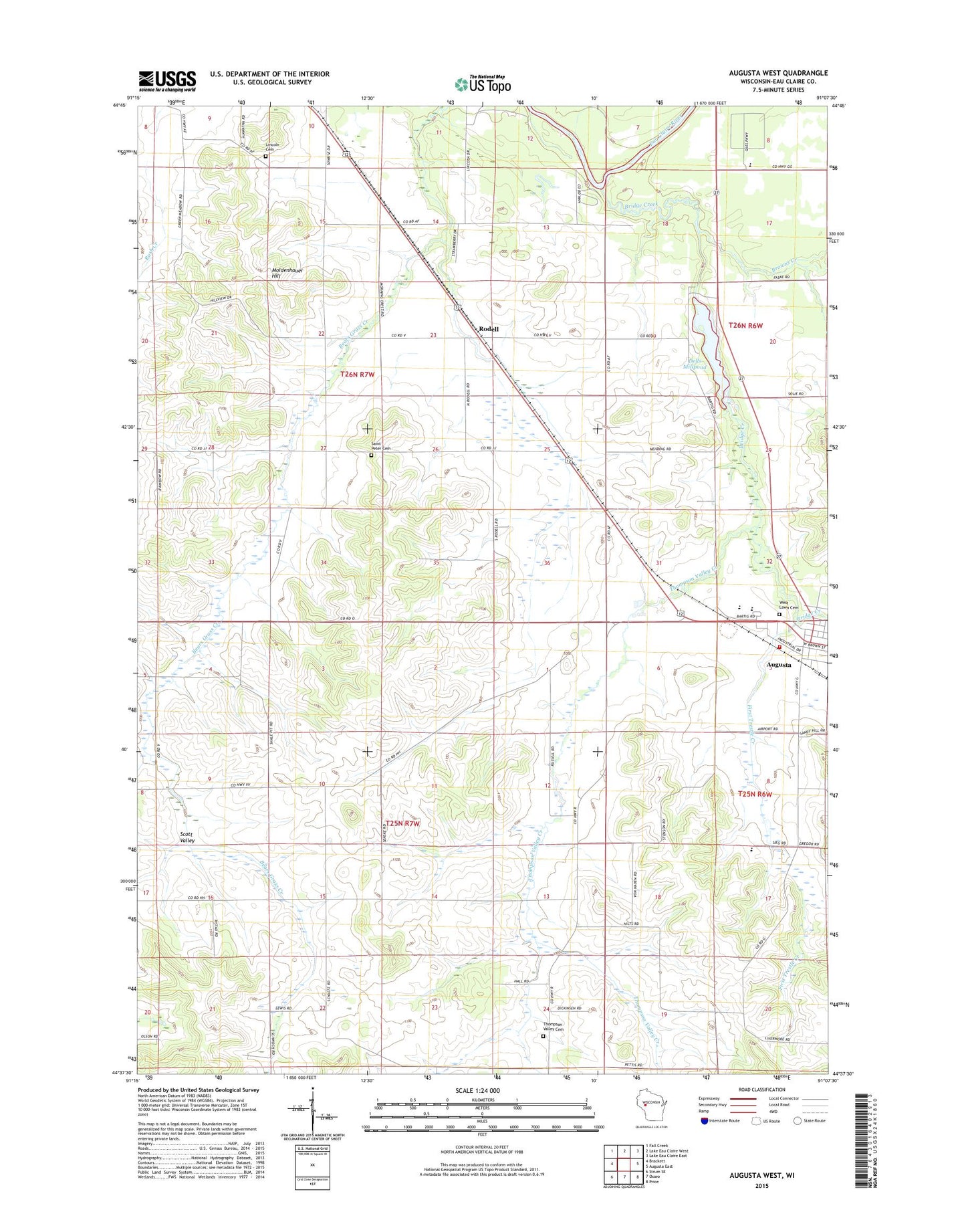
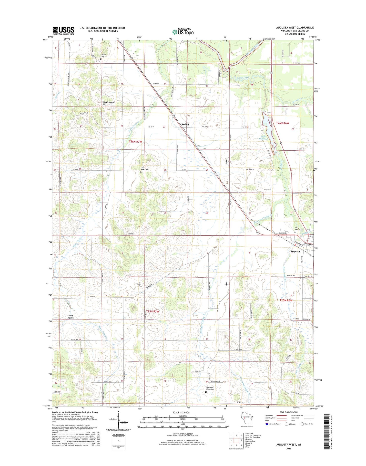
Augusta West Wisconsin US Topo Map
Couldn't load pickup availability
2018 topographic map quadrangle Augusta West in the state of Wisconsin. Scale: 1:24000. Based on the newly updated USGS 7.5' US Topo map series, this map is in the following counties: Eau Claire. The map contains contour data, water features, and other items you are used to seeing on USGS maps, but also has updated roads and other features. This is the next generation of topographic maps. Printed on high-quality waterproof paper with UV fade-resistant inks.
Quads adjacent to this one:
West: Brackett
Northwest: Fall Creek
North: Lake Eau Claire West
Northeast: Lake Eau Claire East
East: Augusta East
Southeast: Price
South: Osseo
Southwest: Strum SE
Contains the following named places: Augusta Elementary School, Augusta Fire Department, Augusta High School, Augusta Mennonite School, Augusta Middle School, Beargrass School, Bears Grass Dairy, Bills School, Bridge Creek, Browns Creek, Brune Farms, Buse Farms, Dells Lake Dam, Dells Millpond, First Trestle Creek, Gabler Farms, Grace Evangelical Lutheran Church, Grace Lutheran Church, Grandpa's Farm Airport, Harstad County Park, Lincoln Cemetery, Lincoln Valley School, Martinson Farms, Mayo Farms, Moldenhauer Hill, Osborn Farms, Plain View School, Rodell, Rugotzke Farm, Russell Corners School, Saint Anthonys Roman Catholic Church, Saint Peter Cemetery, Saint Peters Church, Scott Valley, Scott Valley School, Sieg Landing Strip, Skyglo Farms, Thompson Valley Cemetery, Thompson Valley Creek, Thompson Valley School, Town of Otter Creek, West Lawn Cemetery