MyTopo
Brackett Wisconsin US Topo Map
Couldn't load pickup availability
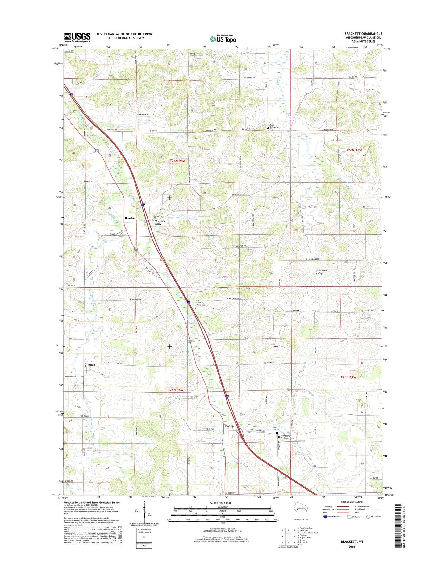
2022 topographic map quadrangle Brackett in the state of Wisconsin. Scale: 1:24000. Based on the newly updated USGS 7.5' US Topo map series, this map is in the following counties: Eau Claire. The map contains contour data, water features, and other items you are used to seeing on USGS maps, but also has updated roads and other features. This is the next generation of topographic maps. Printed on high-quality waterproof paper with UV fade-resistant inks.
Quads adjacent to this one:
West: Cleghorn
Northwest: Eau Claire East
North: Fall Creek
Northeast: Lake Eau Claire West
East: Augusta West
Southeast: Osseo
South: Strum SE
Southwest: Strum
This map covers the same area as the classic USGS quad with code o44091f3.
Contains the following named places: Allen, Beaver Creek, Brackett, Brackett School, Castle Rock Organic Farms, Dehnke Dairy, Dehnke Farms, Eau Claire County, Fall Creek Valley School, Foster, Geske Farms, Green Acres, Gueisler School, Gunderson Farm, Hale Corner, Hale Corner School, Hollys Hilltop Farm, Holy Guardian Angels Cemetery, Holy Guardian Angels Church, Job School, Kluckman Valley, Krenz Farms, Nix Corner, Saint John Church, Saint Johns Cemetery, Saint Luke Cemetery, Saint Peter Church, Saint Peters Lutheran Cemetery, Tarheel Dairy, Town of Clear Creek, Town of Lincoln