MyTopo
Bay City Wisconsin US Topo Map
Couldn't load pickup availability
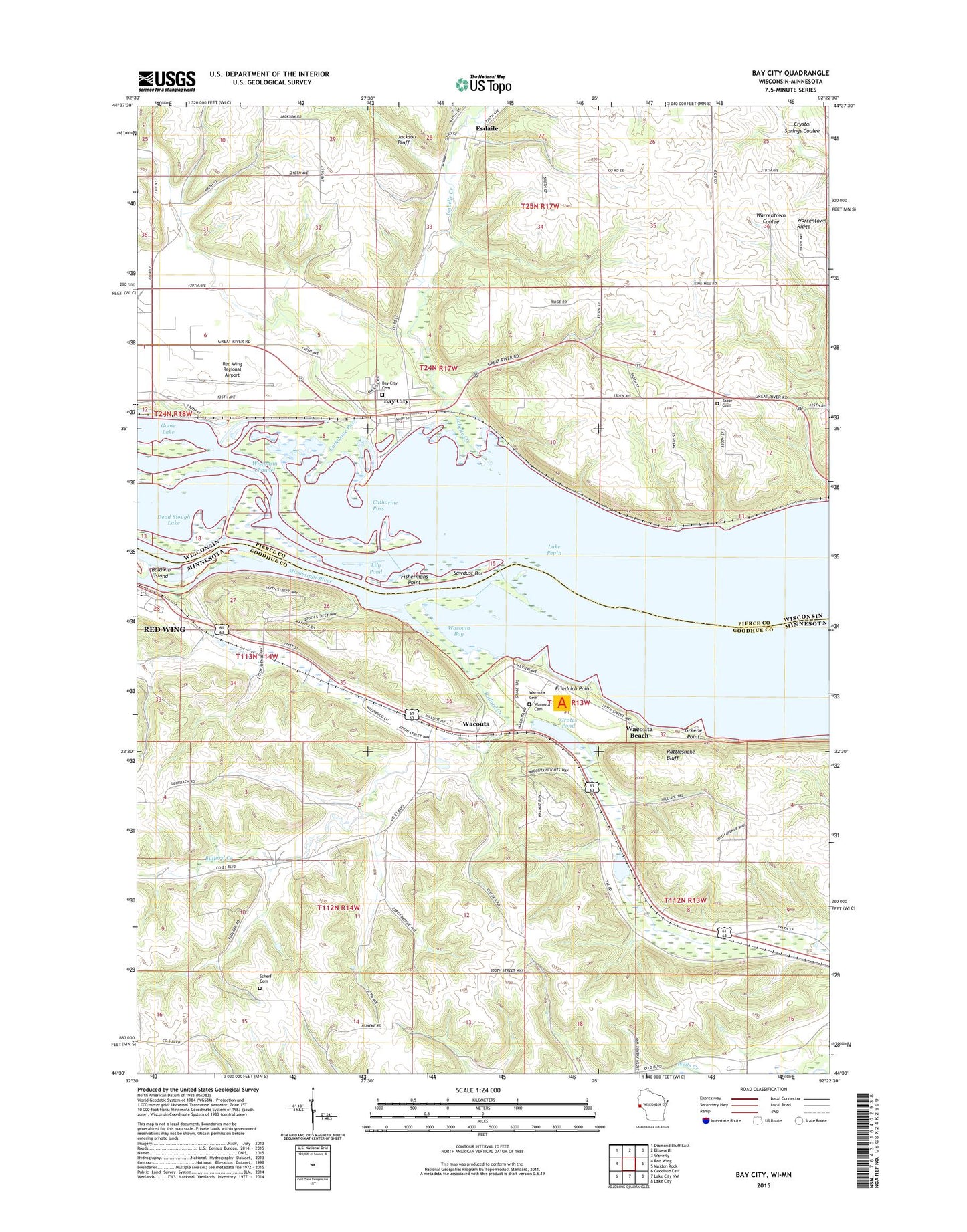
2018 topographic map quadrangle Bay City in the states of Minnesota, Wisconsin. Scale: 1:24000. Based on the newly updated USGS 7.5' US Topo map series, this map is in the following counties: Pierce, Goodhue. The map contains contour data, water features, and other items you are used to seeing on USGS maps, but also has updated roads and other features. This is the next generation of topographic maps. Printed on high-quality waterproof paper with UV fade-resistant inks.
Quads adjacent to this one:
West: Red Wing
Northwest: Diamond Bluff East
North: Ellsworth
Northeast: Waverly
East: Maiden Rock
Southeast: Lake City
South: Lake City NW
Southwest: Goodhue East
Contains the following named places: Baldwin Island, Bay City, Bay City Cemetery, Bay City Post Office, Berean Baptist Church, Bullard Creek, Catharine Pass, Esdaile, Fishermans Point, Forest Home Community Church, Forest Home School, Friedrich Point, Frontenac Hills Apple Farm, Goose Lake, Greene Point, Grotes Pond, Hartland Church, Hedin Island Park, Henry Henricks Dam, Hiawatha Valley Baptist Church, Isabelle Creek, Jackson Bluff, Lily Pond, Minnesota State Training School Entrance Walls, Mississippi National Golf Links, Mount Frontenac Golf Course, Mount Frontenac Ski Area, Oak Hill Mobile Home Park, Oakridge, Oakvale School, Presbyterian Point, Rattlesnake Bluff, Red Wing Regional Airport, Richard J Dorer Memorial Hardwood State Forest, Sawdust Bar, Scherf Cemetery, Tabor Cemetery, Tabor Church, Town of Isabelle, Township of Wacouta, Village of Bay City, Wacouta, Wacouta Bay, Wacouta Beach, Wacouta Cemetery, ZIP Code: 54723